
Posts From GIS Resources
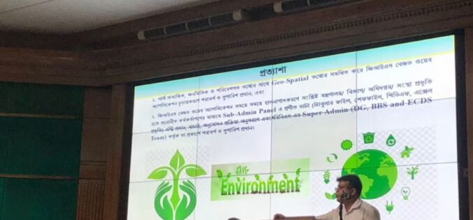
Bangladesh Bureau of Statistics Launch GIS App to Generate Environment, Climate Change Data
That’s great news! Geographic Information System (GIS) technology can be a powerful tool for generating and visualizing data related to the environment and climate change. By using GIS, data from

Septentrio Announces Agnostic GNSS Corrections Partner Program
Septentrio, a global high-precision GNSS location solutions provider, has launched the Agnostic GNSS Corrections Partner Program. This tool makes it easier to use Septentrio receivers with various high-precision services that
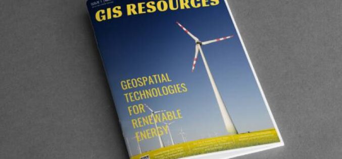
GIS Resources Magazine (Issue 1 | March 2023): Geospatial Technologies for Renewable Energy
GIS Resources is pleased to announce the publication of its 1st edition (March 2023) of the print and digital magazine. The edition is titled “Geospatial Technologies for Renewable Energy.” Renewable energy
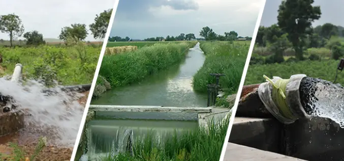
Irrigation Census to Map Natural Water Bodies
In a statement given by the Minister of State for Jal Shakti, Government of India, Shri Bishweswar Tudu, the minister has informed about the minor irrigation census to map natural water bodies.
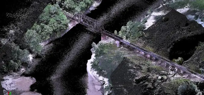
Drone LiDAR for River Scour Survey
Rivers are constantly changing natural systems, and understanding their dynamics is crucial for effective management and planning. One important aspect of river systems is scoured, which refers to the erosion
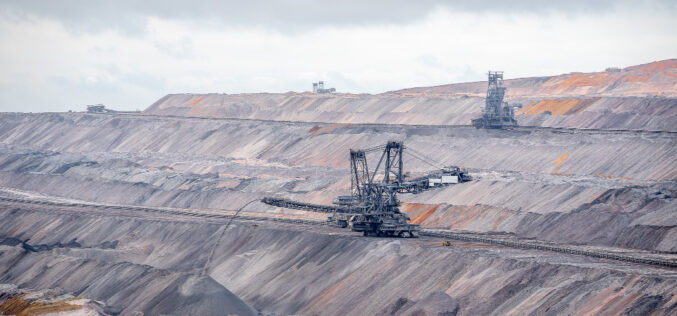
Observation of Landscape Changes in Coal Mining Areas using Satellite Image
Coal mining can significantly impact the landscape and surrounding environment, including changes in land use, vegetation cover, and water resources. Understanding these changes and monitoring them over time is crucial

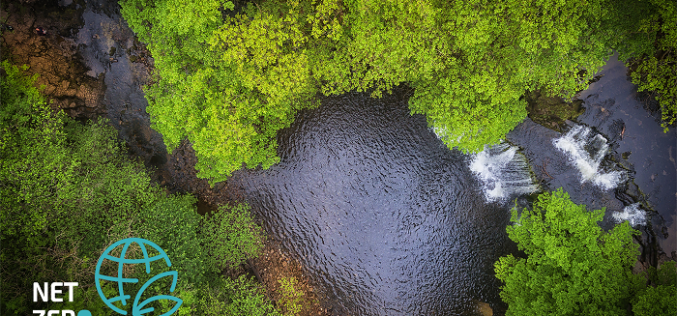
Utilization of Geospatial Data to Mitigate Climate Risk
The increasing impact of climate change has become a major concern for governments, businesses, and communities around the world. Geospatial data, which includes information about the Earth’s surface features, such
Geospatial Tech Firm Sets its Sights on Sustainable Data Solutions
One of the UK’s leading geospatial technology companies is scaling up its data-led asset management support for major utility and infrastructure organisations, helping to minimise their environmental impact. MGISS works with clients such as Northumbrian
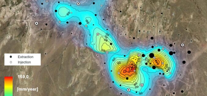
Effective usage of SAR data to monitor Oilfield Ground Displacement
Oilfields are essential to the world’s energy supply, and monitoring their stability is critical to ensure safe and sustainable production. One way to monitor oilfields is through Synthetic Aperture Radar

Usage of 3D Geospatial Data in Smart City
After COVID-19 across the globe, governments are ready to invest in smart city expansion in all possible locations of each geography. The productive outcome of economic development will be reached
