
Posts From GIS Resources
Introduction to GPS
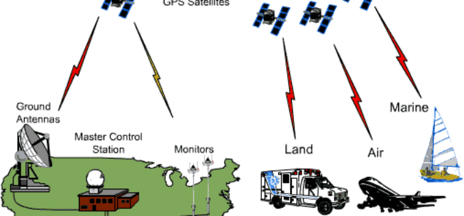
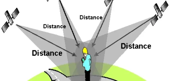
GLOBAL POSITIONING SYSTEM 1. Introduction The NAVSTAR Global Positioning System (GPS) is a satellite-based radio positioning and time – transfer system designed, financed, deployed and operated by US Department of
Fundamemtals of Hyperspectral Remote Sensing
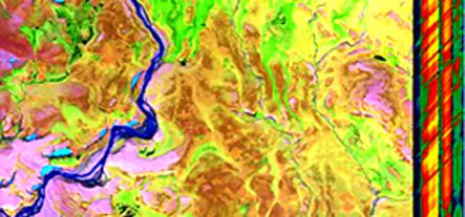
Introduction Hyperspectral remote sensing is the science of acquiring digital imagery of earth materials in many narrow contiguous spectral bands. Hyperspectral sensors or imaging spectrometers measure earth materials and produce

Hyperspectral Remote Sensing
Hyperspectral remote sensing is the science of acquiring digital imagery of earth materials in many narrow contiguous spectral bands. Hyperspectral sensors or imaging spectrometers measure earth materials and produce complete spectral
Snow Cover Mapping using Satellite Remote Sensing Data
Having accurate estimations of snow cover characteristics during the snow-melt season is indispensable for efficient hydrological modeling and snow-melt runoff forecasting. Direct measurements of snow depth at a single station

Topcon announces upgrade to reference station network software
Topcon Positioning Group announces new reference station network software – TopNET+ v10 – bringing new features and functionality to the industry-leading TopNET+ reference station software suite. Topcon’s TopNET+ software is

What is GIS?
GIS stands for Geographic Information System. Introduction This portion provides an overview of GIS. It examines what GIS is, what it can do and, in brief, how it works. One of the
