

Posts From GIS Resources

Why Is Pigeon The Optimal Indoor Positioning System?
Top 5 Benefits of this Indoor Navigation Solution Large facilities such as corporate campuses, conventional centers, healthcare facilities, and amusement spaces such as zoo parks and resorts need a robust
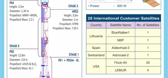
PSLV-C45 Successfully Launches EMISAT and 28 Customer Satellites
India’s Polar Satellite Launch Vehicle (PSLV-C45) today successfully launched EMISAT and 28 international customer satellites from Satish Dhawan Space Centre (SDSC) SHAR in Sriharikota. This flight marked the first mission

Get Your Electricity Ratings Down with these 5 Methods
As a homeowner, there are many reasons why you should try to look for ways you can save on electricity consumption. Of course, a reduction in utility bills is a
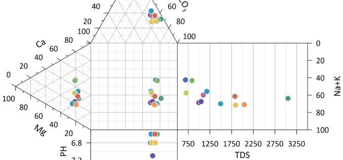
Golden Software Releases Grapher 14 with Enhanced Plotting Functions
GOLDEN, Colorado, 12 March 2019 – Golden Software, a developer of affordable software for data visualization and analysis, has released Version 14 of the Grapher scientific graphing package with new
RME Geomatics Delivers Innovative Drone Technology for Government-Funded Build in Canada Innovation Program (BCIP)
Carp, Ontario– RME Geomatics, a world leading aerial survey services and technology company, announced today they have delivered a Renegade-M aircraft under the Canadian Federal Government Build in Canada Innovation

The Role of Government in Energy Conservation
Energy controls all facets around the globe: businesses, homes, health care, transport, manufacturing and literally everything you can think of. We have all experienced situations whereby the economy is disrupted

How Technology Integration Improved Energy-Saving Industry?
Technology has changed the way we live. These days, we are reliant on technology more than ever. Our homes are full of technology. There is no element in our lives
RMSI Becomes an Esri Utility Network Management Specialty Partner
San Ramon, CA, Feb 1st, 2019: RMSI, a global geospatial technology provider is pleased to announce that it’s been recognized into the Esri Utility Network Management Specialty under the Esri

eGIS Associates designated an Esri Release Ready Specialty Partner
Dacula, Georgia, January 30, 2019 – eGIS Associates is excited to announce that we have been designated as a Release Ready Specialty partner by Esri. The Release Ready Specialty identifies

German DIN Supports Foundations of Datacubes
January 2019 – What is a coverage, after all? This fundamental spatio-temporal data structure, encompassing (among others) datacubes, is widely used, based on adopted and implemented OGC and ISO standards
