
Remote Sensing
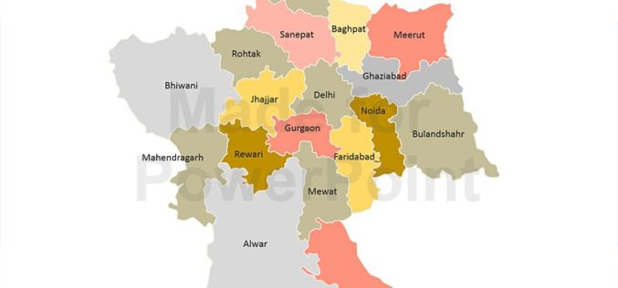
Decline in Natural Conservation Zones in NCR: Govternment
New Delhi: Natural conservation zones (NCZs) like forests, water bodies and waste lands have declined in the National Capital Region, Lok Sabha was informed on Wednesday. As per the analysis
Geospatial Analysis of Biomass in Lake Region of Kumaun Himalaya, Uttarakhand
Abstract The present study includes vegetation and forest biomass mapping in the lake region of Kumaun, Uttarakhand, using IRS1C LISSIII satellite data. A total of 11 forest types including forest
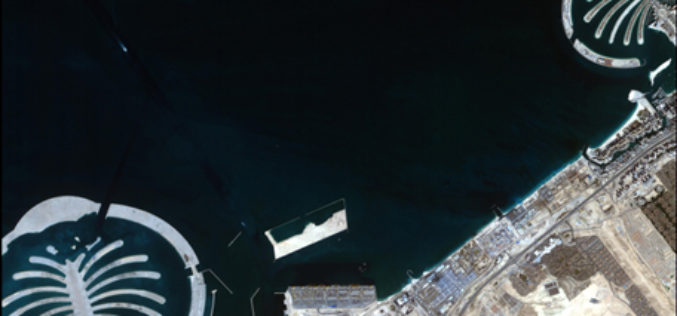
Stunning Images of UAE by DubaiSat-1
According to recent news, DubaiSat-1 (Launched in 2009) has captured all pictures of the Emirates Atlas and still operating efficiently and has now been in space service for five years.
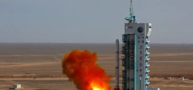
China Successfully Launches Remote Sensing Satellite
BEIJING: China today successfully launched a remote-sensing satellite to carry out scientific experiments and provide early alerts about natural disasters. The Yaogan XX satellite blasted off at 1:45 pm local time on the back of a Long
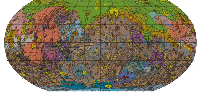
Geologic Map of Mars
Geologic Map of Mars Abstract This global geologic map of Mars, which records the distribution of geologic units and landforms on the planet’s surface through time, is based on unprecedented
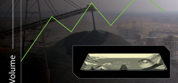
New Automated Stockpile Volume Solution Launches
3D Laser Mapping Brings Fast, Cost Effective Automated Volume Measurement To The Mining Industry 3D Laser Mapping has announced SiteMonitorSV as the latest offering from its suite of SiteMonitor solutions.

Vietnam to Use Remote Sensing in Agriculture
In recent news, Vietnam is gearing up to use Remote Sensing to boost its agricultural production. In a conference last week Le Quoc Doanh, Deputy Minister of Agriculture and Rural

Paragon Addresses Unique Transportation Needs of the Animal Feed Industry
July 31, 2014 – Paragon Software Systems, Inc., a leader in vehicle routing and scheduling optimization solutions, announces a unique transportation solution to target the specific needs of the animal feed industry.
Landsat and Water—Case Studies of the Uses and Benefits of Landsat Imagery in Water Resources
The Landsat program has been collecting and archiving moderate resolution earth imagery since 1972. The number of Landsat users and uses has increased exponentially since the enactment of a free
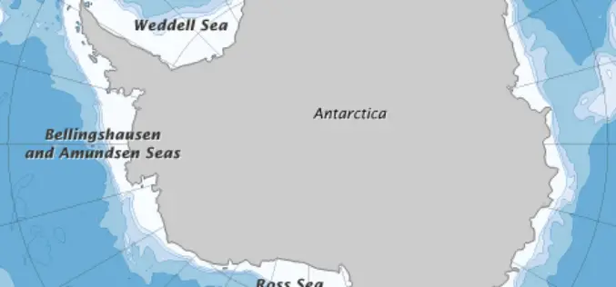
Error Discovered in Antarctic Sea-ice Record
Rising temperatures have caused the amount of Arctic sea ice to shrink dramatically since global observations began in the 1970s. But on the other side of the world, sea ice
