
Remote Sensing

Upcoming Changes to USGS ESPA Processing and Output options of Surface Reflectance Climate Data
Today I received an email from USGS as a notice of changes coming soon to the USGS EROS Science Processing Architecture (ESPA) interface (https://espa.cr.usgs.gov/) , that allows you to process Landsat 4/5 Thematic
Earth Station on Brazilian Land to get Data from IRS
In recent news, Prime Minister’s Office has informed that India and Brazil on Wednesday signed an agreement in Brasilia on cooperation in augmentation of a Brazilian earth station for receiving and

Free Climate Data for Germany of the Climate Data centre
The Deutscher Wetterdienst (DWD) makes available the whole collection of climate data it acquires, processes and archives. The CDC offers accesss to climate data for Germany, but also to data with

Chinese Remote Sensing Drone Sets 30-hour Flying Record
A new Chinese unmanned aerial vehicle (UAV) set a new record for the country’s remote sensing drones by flying for more than 30 hours consecutively, the UAV’s developer, the Chinese
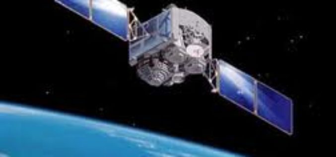
ISRO planning to launch French satellite SPOT 7 on June 26
ISRO is planning to launch its next rocket PSLV C23 carrying a French remote sensing satellite SPOT 7, along with four others from Sriharikota spaceport on June 26, a senior
Back to Back Three Satellite Launches by Iran Next Year
The Zafar, Tolou and AutSat are the three Iranian remote sensing satellites are line up to launch using Simorgh Launcher in the coming year (to start March 21, 2015). These
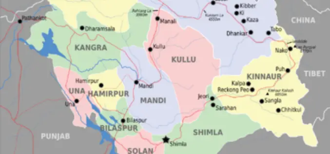
Glaciers and Lakes Mapping in Himachal Pradesh
In recent new, Scientists are mapping the glaciers and lakes in Himachal Pradesh keeping in mind the climate vulnerability and hazards. State Centre for Climate Change will map all glaciers
Pakistan Gets First Remote Sensing Lab
In recent news Dawn, Pakistan gets first remote sensing lab at Hyderabad established in collaboration with the Pakistan Space and Upper Atmosphere Research Commission (Suparco) and the Food and Agriculture
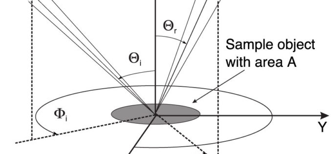
Monostatic Measurement of the Polarized Bidirectional Reflection Distribution Function
Monostatic Measurement of the Polarized Bidirectional Reflection Distribution Function by Oscar G. Rodríguez-Herrera and J. Scott Tyo Controlling the spatial coherence and polarization of electromagnetic waves sheds new light on the
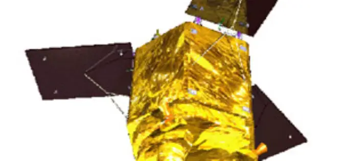
Kazakhstan’s EO Satellite KazEOSat-1 Launched Successfully
Kazakhstan first ever remote sensing or earth observation satellite, KazEOSat-1,was to launched from Kourou, The Space Centre of French Guinea on April 29, 2014. But was postponed due to weather
