Copernicus Emergency Management Service release Flood Maps of Hudhud Affected Andhra Pradesh, India
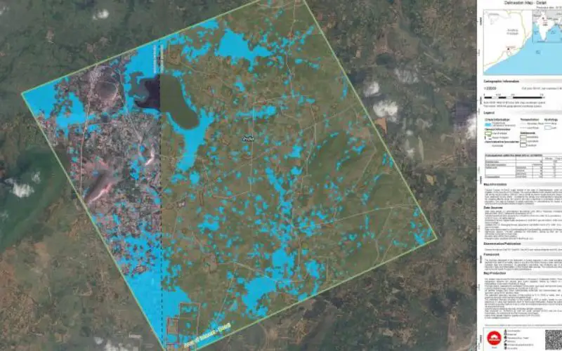
ANAKAPALLE: Delineation Map GIO EMS – Mapping
Very Severe Cyclonic Storm Hudhud was the strongest tropical cyclone of 2014 within the North Indian Ocean, as well as the costliest storm in the basin since Cyclone Jal in 2010. Hudhud originated in the Andaman Sea on October 6 and shortly before landfall near Visakhapatnam, Andhra Pradesh on October 12, Hudhud reached its peak strength with three minute wind speeds of 175 km/h (109 mph).
GIO EMS – Mapping provides all actors involved in the management of natural disasters, man-made emergency situations and humanitarian crises, with timely and accurate geospatial information derived from satellite remote sensing and completed by available in situ or open data sources.
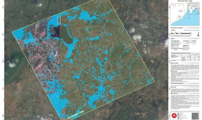
Cyclon Hudhud affected north coastal Andhra Pradesh with strong winds and heavy rainfall, as well as storm surge along the coast. GIO EMS – Mapping has released total of 18 maps, 9 of them are reference maps and 9 are flood delineation maps.
Reference maps are produced using satellite images and can be downloaded in JPEG, PDF, TIFF and vector format. The maps are produced in scale of 1:22000.
Flood delineation maps can be downloaded in JPEG, PDF, TIFF and vector format. The maps are produced in scale of 1:22000.
Read more at: http://emergency.copernicus.eu/mapping/list-of-components/EMSR104