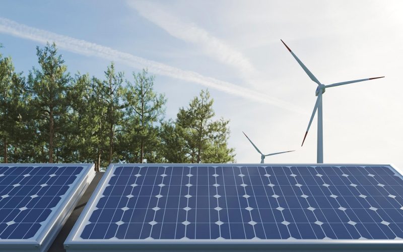

Energy is always in demand both for household and industrial use, and the Earth’s population has to manage energy source depletion before running short. Renewable energy sources are a great solution to this issue, and satellite remote sensing technology helps in its control. Furthermore, such sources can fuel remote sensing itself, for example, solar illumination is used to recharge the batteries of satellites operating in space.
Space technology nowadays assists in researching the energy of the sun, water, and wind, and mapping their favorable concentrations. Satellites can provide data on water temperatures and speed flows to predict their effect on environmental communities.
Space Monitoring Technology
With all the useful insights that geospatial technology can highlight in multiple spheres, raw satellite imageries often need help comprehending and require proper spatial analysis. EOS Data Analytics (EOSDA) is among the leading companies that provide satellite analytics worldwide. EOSDA harnesses artificial intelligence and machine learning to obtain readable data for 22 industries, with a keen focus on the monitoring of agricultural lands.
EOSDA analytics prompts well-grounded and effective decision-making in every segment of the agricultural sector, enabling the company’s clients to have more profitable businesses. However, EOSDA products and services have been developed with environmental protection and sustainability in mind.
Together with Greenpeace Global Mapping Hub, EOS Data Analytics co-hosted a free webinar in October 2022. The online event was devoted to the assistance of crop monitoring systems and other satellite technologies in supporting a sustainable environment by promoting responsible forestry and agriculture. Webinar presenters also covered the capabilities of EOSDA products in environmental monitoring, which is important in research undertakings and mitigating the negative footprint of farming activities on planet Earth.
In January 2023, the company launched the first satellite of its 7-unit proprietary EOS SAT constellation and completed its service-rendering cycle, including data retrieval, processing, and delivery of geospatial imagery analytics. So far, EOS SAT is the first satellite constellation specially designated for farming needs, thus leading out satellite crop monitoring on essentially advanced levels. Among other advantages, space technology and satellite imagery analytics help in reducing resources and energy use, as well as in adopting renewable options. EOS Data Analytics is highly dedicated to making its contribution to the renewable energy sector by:
- identifying favorable locations for wind farms and solar plants;
- monitoring their operation;
- assisting in the management and optimization of their work.
Sources of Renewable Energy
As the name suggests, renewable energy is one with the possibility to be naturally restored, and the main idea about renewables is that they can be replenished faster than they are consumed. Such sources are numerous. The most typical examples of renewable energy sources are solar light and wind. Others include hydropower from water streams, vegetation biomass energy, geothermal energy (internal heat of our planet), and more.
Renewable power is relatively cheaper and is by far friendlier to the environment than traditional one.
Solar Power
Solar energy is the energy of sunlight that is typically collected and converted to electric power in photovoltaics. The greatest advantages of this source are that the Sun provides this energy in abundance, and solar energy production by panels does not imply harmful greenhouse gas emissions, say, as fossil fuels do. Solar energy has been used to heat water in outdoor tanks and generate electricity for individual households, industrial enterprises, educational and healthcare institutions, governmental and non-governmental organizations, spacecraft, farming equipment, automobiles, etc.
Because traditionally derived energy becomes more and more expensive year by year, solar power gains more popularity and a wider scope of applications. In this regard, geospatial technology turns helpful in solar radiation quantifying and modeling, as well as solar plants deployment, maintenance, optimization, and monitoring.
Increase Energy Production through Terrain Simulations
Satellite-derived geospatial data proves useful in solar energy generation and transportation. Georeference and GIS mapping allow for thorough control of solar plant operation in a specified location:
- timely response to any technical issues;
- equipment failure prevention measures;
- quantitative and qualitative power generation predictions;
- assessment of environmental impacts;
- minimization of competition with wildlife habitats and agricultural lands.
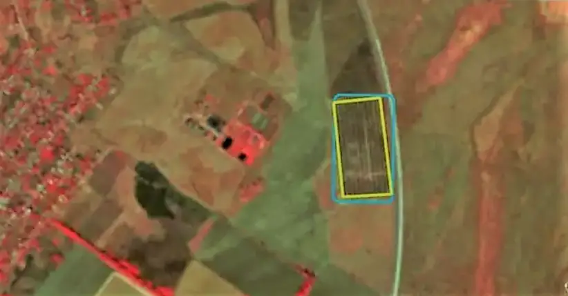
Floating solar plants seem to be a promising alternative to land-based deployment since this option doesn’t only eradicate the expansion of agricultural and wildlife territories but allows for water cooling of equipment systems. However, choosing favorable water surfaces for suitable solar panel locations is often challenging, and this is where satellite technologies can help.
Furthermore, satellite data enable experts to calculate current and potential solar energy generation on a certain territory. The correlation between square meters and the amount of energy produced helps to optimize the plant area coverage and minimize the aforementioned agricultural and wildlife competition. High-resolution imagery (30 cm-1 m) helps determine the most favorable solar plant location, and frequent satellite revisits (up to several revisits per day) allow for effective operation control. All in all, geospatial data can tell an expert if the questioned water or ground surface is suitable to house a solar plant and enables preliminary calculation of the optimal terrain’s size.
Optimization and Improvement upon Solar Panel Maintenance
After deployment, solar plant facilities require systematic control that ensures their proper functioning, and monitoring through geospatial data allows for adequate equipment maintenance. Providing valuable insights remotely, satellite imagery is particularly useful when it comes to controlling large territories, while GIS data shows the exact place with probable equipment failures.
Such failures may occur due to physical damage by birds, downpours, or windstorms, and can be detected by high-resolution optical satellite imagery. Furthermore, solar panel malfunctioning due to weather extremities can be prevented if managers are aware of impending events, thanks to satellite-driven weather forecasts.
On top of that, geospatial technology can do even more. Radar-equipped remote sensing media can identify malfunctioning issues like overheating, which is not visible to the human eye. In every detected case, solar plant facilities require proper human inspection, but geospatial technology speeds up troubleshooting with early warnings.
Bioenergy
Plants are capable of turning sunlight energy into chemical one in the process of photosynthesis. So, vegetation biomass can be further converted into bioenergy either by direct burning or making liquid and gaseous biofuels. However, plants are not the sole bioenergy source. Other sources to derive renewable energy include animal manure human sewage and organic wastes. Examples of biomass for renewable energy comprise:
- Wood and all sorts of timber procession wastes, including wood proper, wood pellets, chips, sawdust, and lignin-rich black liquor from wood pulp.
- Organic urban wastes like paper, cotton, wood materials, and culinary wastes.
- Animal manure and fats as well as human sewage for biofuel (biogas) production.
- Technical agricultural crops for biofuel production and their residues: corn, sorghum, rape, canola, soybeans, sugarcane, sugar beet, and others.
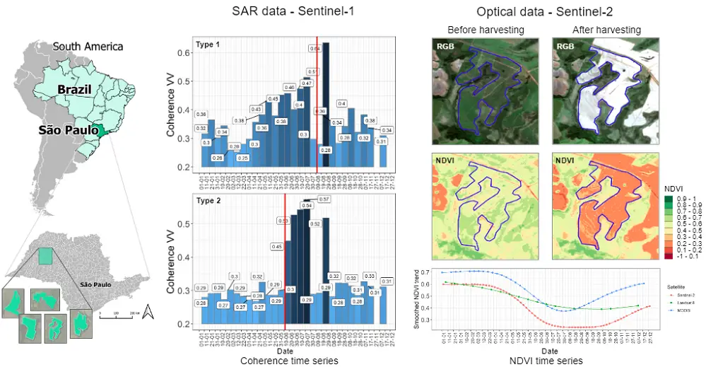
The demand for technical biofuel plants urges the expansion of land for their production, but crop monitoring – and respectively farm management – turn challenging when the areas are vast. Nonetheless, satellite imagery can be helpful in this regard, providing regular monitoring of agricultural lands.
By making data-driven decisions, agriculturalists can increase their business profitability and mitigate the negative impact on the environment by decreasing chemical pollution. In particular, satellite crop monitoring provides information on soil moisture, weather conditions, and other important agricultural factors. Satellite-derived vegetation indices report plant greenness intensity, which allows for assessing crop productivity and making necessary amendments in growing conditions.
However, farmers are not the only users of crop monitoring systems. Satellite remote sensing provides actionable insights for all renewable energy stakeholders and is helpful in business planning, policy-making, enterprise establishment and deployment, crop processing, transportation, energy distribution, and more.
Crop monitoring also helps to detect low-yielding agricultural fields suitable for second-generation biofuel production. Assessing the farm productivity allow for predicting raw material supplies and deciding on favorable locations for processing enterprises. Satellite data is also used to estimate the potential of abandoned farming areas for the renewable energy sector.
Wind Energy
Energy-production capacity of wind was discovered millennia ago. The wind potential on our planet is enormous, and by far exceeds the potential for traditional electric power production. Wind energy is derived from large turbines rotated in windy weather, and the stronger the wind gusts, the more energy can be produced.
Humankind can flaunt the successful experience of using wind farms both on water surfaces and land (off-shore and on-shore respectively). However, this alternative energy sector has considerably advanced in recent years. Apart from the industrial potential to produce more powerful equipment with bigger turbines, present-day wind energy production and its management are strongly supported by remote sensing applications.
There are windy days in any Earth’s corner, yet not every place is suitable for a wind plant site. Tracking weather trends through historical satellite data allows for choosing the best location, and regular wind farm monitoring from space facilitates managerial decisions.
The best sites to house wind farms are often located in remote places, so their control with geospatial technology is quite often the only feasible option.
However, typical weather trends and climatic peculiarities are not the only information that satellites can provide. GIS mapping contains several layers, and the best thing is that they can be collected in a single interactive map, which is very convenient for analysis. To realize the area’s potential, a wind energy expert needs to know:
- density of the local population for consumption assessment;
- distance to roads for the best logistic solutions;
- land use for understanding possible environmental impacts;
- area slope and elevation (which often affects wind speed);
- wind properties for an adequate resource assessment.
Essential wind properties include wind speed (velocity), as well as density and volume of air masses (respectively the mass and amount of air). Understanding the resource potential is important to calculate the required height of turbines and the size of their rotors, as well as decide on the best deployment.
Combined with ground topographic data and other sources, GIS maps reveal all determining parameters to make the best location choice, as well as outline the area limitations. Such limitations include transmission lines or bird migration routes and other environmental factors. Having all the necessary data at hand in a single GIS map prompts brilliant decisions.
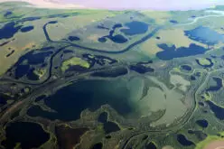
Hydropower
Nowadays, hydropower stations produce the greatest amounts of renewable electricity worldwide using the energy of water. Hydropower production relies on the law of gravity and it is generated by flowing or dropping water currents. Hydropower stations can be installed either on still water bodies or rivers, where water flows from higher to lower locations.
Proper operations of hydropower stations strongly depend on the amounts of available water typically supplied with regular rainfall. Correspondingly, droughts adversely affect the capacity of hydropower stations and can cause their malfunction.
When planning and constructing hydropower stations, experts need to analyze the proximity of water bodies, as well as rainfall patterns in the area. Geographical information systems (GIS) can help to decide on possibly suitable locations.
Hydropower stations vary in area and equipment size, from large-scale plants with huge dams to local run-of-river facilities. Their size affects their deployment, varying in area size, investment and maintenance costs, environmental impact, as well as the time for construction, staff training, and other factors. Respectively, smaller projects are less expensive and faster to deploy but the capacity of their facilities and generated hydropower volumes are also lower.
Typically, run-by-river turbines are rotated with water passing through penstock pipelines, entering them from higher locations and further flowing downstream the river.
The great thing about geospatial technology (and particularly, geographical information systems) is that it enables hydrological modeling. It becomes possible by combining topographic and weather data, both from the ground and space. A GIS map includes data on elevation (DEM, or Digital elevation models), soil properties, soil cover, land use, riverbed boundaries, watershed areas, and climatic peculiarities (rainfall, relative air humidity, current and accumulated temperatures, wind speed, etc.).
Understanding accurate water amount potential and knowing regional peculiarities help determine water-generated electricity prices and specifics of dam construction, e.g., their length, height, drainage positioning, etc. Such insights are also useful to optimize hydropower station operations.
In some northern countries with abundant snowfall like Norway, hydropower stations can cover nearly all electricity needs, and satellite-based digital elevation modeling turns extremely useful. It allows for predicting snow-melting run-offs that can be used to produce hydroelectric power. Such predictions are made by analyzing the thickness of snow cover, soil temperature, weather temperature, wind speed, and other parameters collected both from available space and ground data sources.
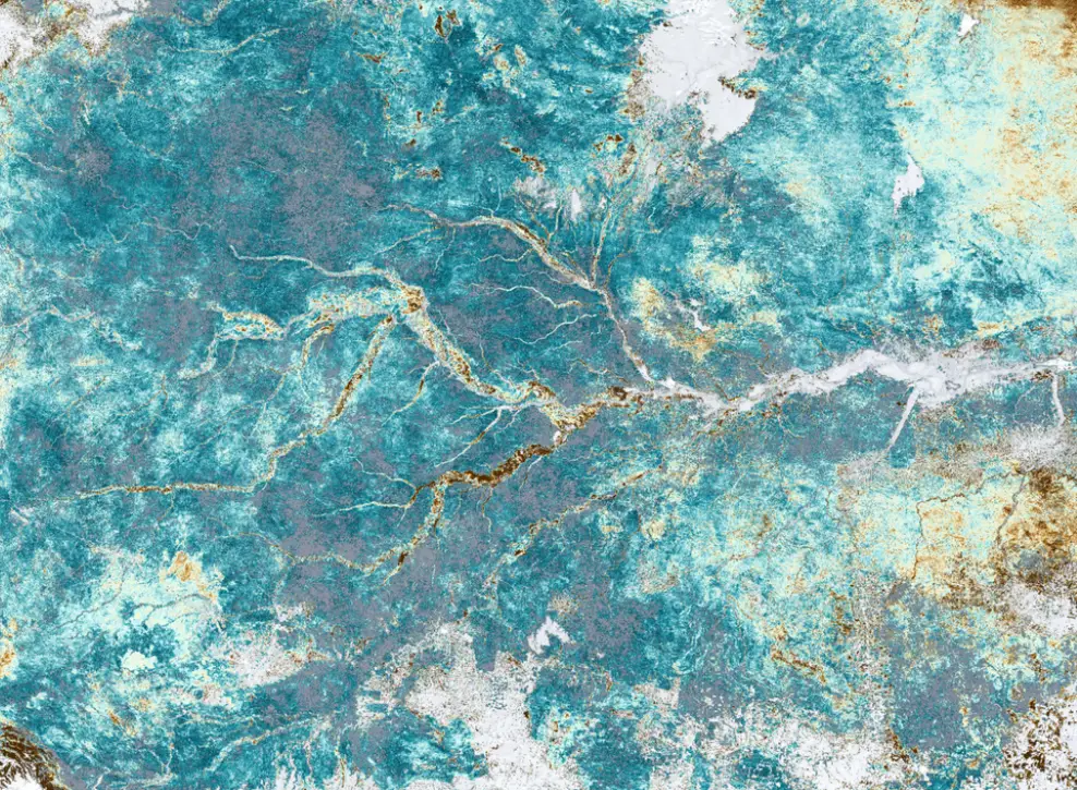
Satellite imageries are acquired by optical and radar sensors. While optical imagery data may be insufficient due to cloud cover, radar satellites provide the necessary information even when the sky is overcast.
Thus, geospatial technology is used in assessing potential water volumes and hydropower produced, as well as predicting floods and mitigating their consequences.
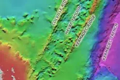
Geothermal Energy
Geothermal energy is also used as a source to generate alternative energy through the heat stored inside the Earth. The heat in the core of our planet accumulated after its formation and was released in the process of radioactive agents’ splitting. Geothermal energy can be found far beneath the Earth’s surface – namely, in its center. The main sources of geothermal energy are the Earth’s core fluids and hot rocks.
The probing of suitable sites for harvesting this energy type is typically performed by drilling. This method allows for measuring the temperature in the heart of our planet at different depths. Drilling is quite an accurate method but it involves considerable financial inputs and human efforts. SAR-equipped (synthetic aperture radar) satellites offer a comparatively cheaper method to identify the Earth’s geothermal potential. Furthermore, SAR remote sensing is extremely handy for remote and hard-to-reach places.
SAR satellite imageries are suitable not only for a direct and indirect mapping of potential locations of geothermal energy plants and planning their favorable deployment but for the monitoring of geothermal energy harvesting and optimization of facilities exploitation.
Different methods of SAR data analysis allow for understanding the geophysical, geochemical, and geological properties of our planet. Furthermore, Earth observation has been considerably improved by a rising number of satellites with better equipment and more frequent revisits. Besides, thermal infrared sensors are reliable media to provide accurate information. Suitable geothermal energy plant locations can be also identified with thermal springs and other visible on-ground markers or aerial vehicles.
These data sources are augmented with remote sensing, and advanced technologies of digital satellite imagery processing and AI-powered analytics open up new horizons to unlock the geothermal and other alternative energy potentials of our planet.
This article was first published in the GIS Resources Magazine in March 2023.