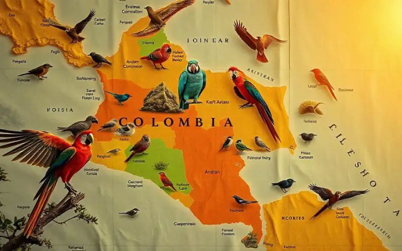
A team of Colombian researchers, led by Natalia Ocampo-Peñuela, assistant professor of environmental studies, has introduced new mapping techniques that are transforming Colombian bird mapping and conservation efforts.
Published in Diversity and Distributions, their study provides high-resolution range and Area of Habitat (AOH) maps for nearly all of Colombia’s terrestrial birds, covering 94 percent of resident species. This data arrives as Colombia hosts COP16, highlighting its role in advancing biodiversity protection.
Methods and Materials
To achieve more precise Colombian bird mapping, the research team combined several methodologies to build comprehensive maps. They employed a mix of expert-drawn maps, probabilistic modeling, elevation data, and community science contributions from eBird—a global platform where birdwatchers share species observations.
This collaborative data provided the researchers with valuable ecological insights, allowing for a highly accurate view of species distribution. By integrating these multiple data types, the study addresses critical gaps left by traditional mapping, which often lacks the precision required for local conservation planning.
Moreover, the researchers applied probabilistic models that incorporate variables such as elevation and habitat type, which are essential for depicting bird habitats accurately. By layering this information with community-submitted observations from eBird, the team built maps showing species range and habitat, with each pixel representing a degree of certainty.
This unique transparency ensures that conservationists can assess areas with high biodiversity value and recognize regions where additional data collection is needed.
Also Read – Harnessing Geospatial Technologies for Wildlife Conservation
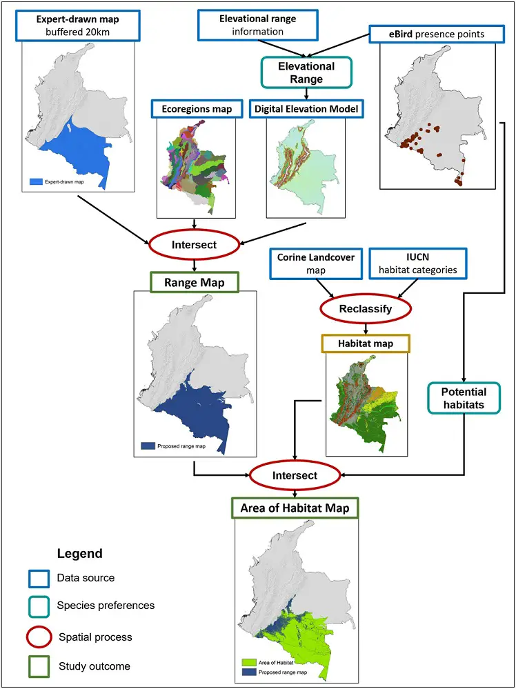
Image Source: https://onlinelibrary.wiley.com/doi/10.1111/ddi.13917
The study’s findings present a new, detailed view of Colombia’s biodiversity hotspots, especially in regions such as the Andean-Amazon transition zone and the Chocó, both rich in bird species and historically understudied. The maps highlight species richness, showcasing areas with high numbers of endemic and threatened species.
“These maps provide a clearer picture of species richness and biodiversity hotspots,” explained Ocampo-Peñuela. “In regions like the Amazon, where deforestation poses a constant threat, these insights are invaluable for conservation planning.”
In particular, Colombian bird mapping has revealed how crucial these biodiverse areas are in the global conservation context. The Andean-Amazon zone, for example, is losing forest cover rapidly. The new mapping techniques allow conservationists to understand not only where birds are concentrated but also how these areas are impacted by habitat loss, giving rise to strategies that can protect these critical regions.
Advancing Community Science
Beyond its technical innovations, the study emphasizes the importance of local community involvement in ongoing biodiversity monitoring. Ocampo-Peñuela advocates for building local capacity in biodiversity monitoring, which contrasts with “parachute science” practices where foreign experts briefly conduct studies and leave.
“If we want comprehensive biodiversity data, empowering local communities to monitor their ecosystems is essential,” she stated. The team believes that increasing local involvement will foster a lasting conservation culture, especially in remote areas like the Amazon and Darién Gap.
The Colombian bird mapping study underscores the importance of community science in closing data gaps. Local communities, when equipped with monitoring tools and training, can provide continuous, authentic insights into Colombia’s ecological dynamics. This approach ensures a sustainable data collection framework that can inform conservation strategies for years to come.
Practical Applications and Global Implications
The open-access nature of these maps is a key benefit, allowing them to be updated continuously as new data emerges. This adaptability makes Colombian bird mapping an essential tool for other biodiversity-rich countries, particularly those aiming to meet global conservation targets, such as protecting 30 percent of the planet by 2030. Suárez-Castro highlighted the broader potential: “The use of community science data is key, and encouraging local involvement will help us protect biodiversity across Colombia and beyond.”
By setting a model for transparency and precision, Colombia is establishing itself as a leader in conservation science. This study showcases how advanced mapping methods, paired with community involvement, can support meaningful conservation, ensuring both local ecological needs and global biodiversity goals are met.
This research, rooted in Colombian bird mapping, highlights the effectiveness of integrating cutting-edge technology and local knowledge to tackle global conservation challenges. As global biodiversity targets progress, Colombia’s approach offers a valuable model for conserving fragile ecosystems worldwide.
Source: UC Santa Cruz


