In collaboration with NASA, IBM has launched the Prithvi-EO-2.0 Platform, a groundbreaking geospatial AI tool designed to tackle critical environmental, social, and economic challenges. With its cutting-edge technology, extensive datasets, and open-source foundation, this platform is redefining how geospatial data is processed and applied.
A Leap in AI Capabilities
At the heart of this initiative is Prithvi-EO-2.0, the latest AI model within the platform. With 600 million parameters, it is six times larger than its predecessor, which was already the world’s largest geospatial AI model upon its release in August 2023. Developed in collaboration with Germany’s Jülich Supercomputing Centre, the model was pre-trained on a geographically diverse dataset and includes embeddings that capture rich spatial and temporal relationships.
This advanced model was trained on 4.2 million data points from NASA’s Harmonized Landsat Sentinel (HLS) dataset, achieving remarkable performance on the GEO-bench framework—a standard for evaluating AI models in satellite image classification and segmentation. Prithvi-EO-2.0 scored an impressive 75.6%, an 8% improvement over the previous version, demonstrating its enhanced capabilities in handling complex geospatial data.
Also Read – Exploring the Power of IBM Environmental Intelligence APIs for Geospatial Insights
Technology and Availability
The Prithvi-EO-2.0 model is available on Hugging Face and IBM’s TerraTorch toolkit as part of NASA’s Office of the Chief Science Data Officer’s initiative to make satellite data more accessible through innovative technologies.
Equipped to analyze HLS data at a resolution of 30 meters per pixel, the model can zoom in closer to identify details such as crops, tree species, cattle, and solar panels. This level of granularity allows users to address challenges across agriculture, environmental conservation, and infrastructure development.
Real-World Applications
The platform is designed to support a wide range of applications:
- Environmental Monitoring: Tracking carbon flux, deforestation, and biodiversity changes.
- Disaster Management: Identifying landslide-prone areas and aiding disaster recovery efforts.
- Land Cover Classification: Offering detailed insights into land use changes at different scales.
NASA experts played a crucial role in the model’s development, ensuring its design, training data, and performance metrics align with real-world applications.
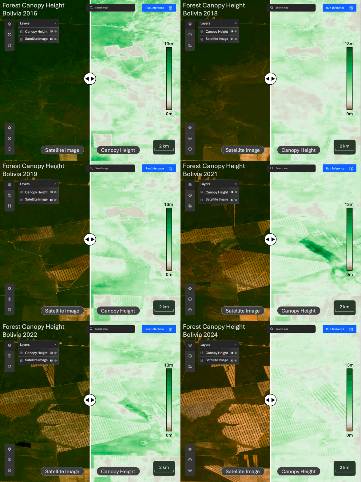
Image Source: IBM
Unprecedented Performance
IBM researchers attribute the model’s success to the close collaboration with NASA. This partnership enabled the integration of innovative applications like landslide detection and carbon flux estimation, enhancing the platform’s versatility.
The improved accuracy and efficiency of Prithvi-EO-2.0 are critical for addressing global challenges, from climate change to resource management.
A Step Toward the Future
The platform exemplifies the power of collaboration between leading organizations. Combining NASA’s satellite expertise with IBM’s AI innovation, the platform sets a new benchmark for geospatial analytics. Its open-source nature ensures accessibility, enabling researchers and developers worldwide to harness its potential for their unique challenges.
Conclusion
The launch of the Prithvi-EO-2.0 marks a transformative moment in geospatial AI. With its advanced capabilities, extensive applications, and open accessibility, it is empowering industries to make informed, data-driven decisions. By bridging the gap between data and actionable insights, this platform paves the way for a sustainable and resilient future.
Source: IBM


