Recent advancements in LiDAR (Light Detection and Ranging) technology have revealed hidden remnants of Silk Road cities in Uzbekistan, uncovering archaeological treasures that had remained buried for centuries.
The discovery was led by Michael Frachetti of Washington University in St. Louis and Farhod Maksudov from Uzbekistan’s National Center of Archaeology. This discovery sheds light on the rich history of Central Asia’s trade networks and showcases how modern technology is transforming archaeological research.
These findings also challenge long-held assumptions about trade routes and reveal the critical role that high-altitude cities played in the Silk Road’s economic network.
Uncovering Tashbulak and Tugunbulak
The research focused on two ancient cities, Tashbulak and Tugunbulak, both located at about 2,000 meters above sea level. These cities flourished between the 6th and 11th centuries, showcasing how trade and cultural activities thrived in regions once thought to be obstacles to commerce.
The project began with the discovery of Tashbulak in 2011 and expanded in 2015 to include Tugunbulak, offering a more comprehensive understanding of Central Asia’s medieval urban landscape.
Also Read – Airborne LiDAR Reveals Maya Civilization Landscape
LiDAR’s Role in Revealing Ancient Silk Road Cities in Uzbekistan
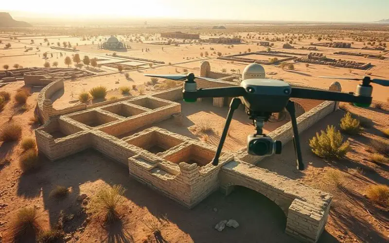
LiDAR technology played a crucial role in uncovering the hidden secrets of these high-altitude settlements. Using drone-based LiDAR, Frachetti’s team captured high-resolution images of the cities, revealing intricate details buried under centuries of natural erosion and vegetation:
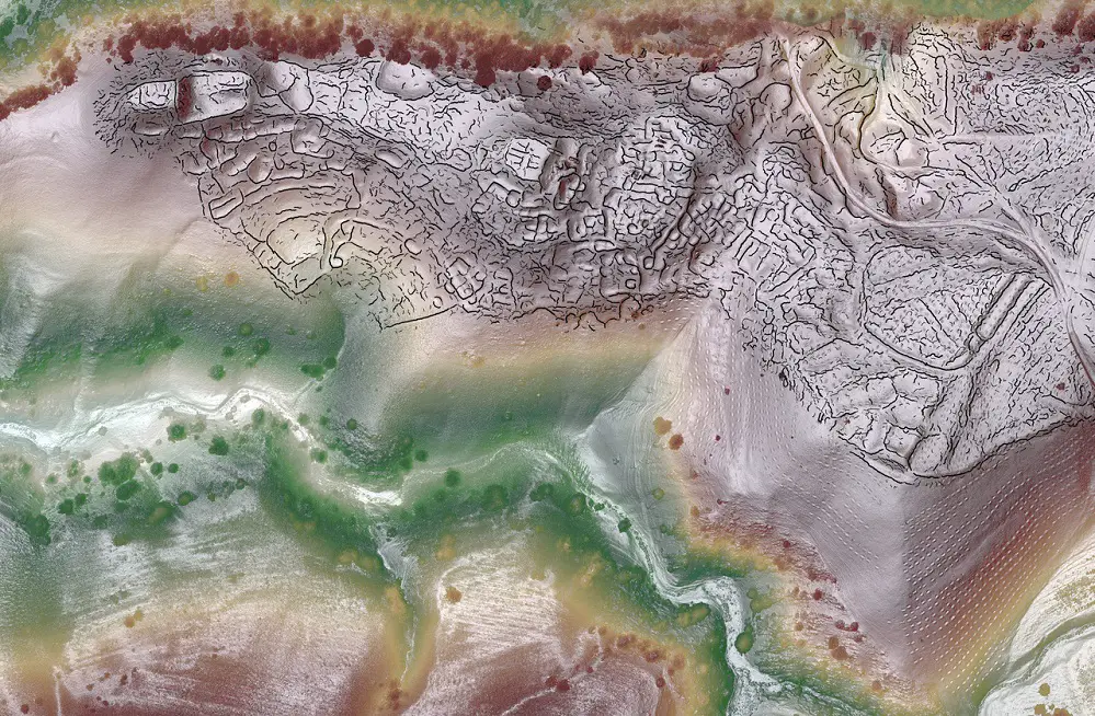
- Tugunbulak, the largest of the two cities, covered an area of 120 hectares and included over 300 structures. These structures featured watchtowers, defensive walls, narrow corridors, and a central fortress believed to be part of a larger palace complex.
- Tashbulak, a smaller city spanning 12 hectares, was noted for its terraced platforms and fortified buildings.
Frachetti highlighted that the high-resolution imagery provided unprecedented clarity, uncovering complex layouts with fortresses, plazas, roads, and residential zones.
Also Read – GIS Resources Magazine (Issue 1 | March 2020): Geospatial Technologies to Preserve Heritage Monuments
Economic Insights from Excavations
Excavations at the sites, which have been ongoing since 2022, uncovered evidence of large-scale iron production, indicating the cities’ economic reliance on metalworking. The surrounding forests were likely vital for fuel and metal production, contributing to the cities’ rise and eventual decline.
Radiocarbon dating suggests that both Tashbulak and Tugunbulak experienced a decline in the early 11th century, likely due to environmental strain and political factors.
Challenging Traditional Views of the Silk Road
The discoveries made through LiDAR technology are reshaping historical narratives about the Silk Road Cities in Uzbekistan. The high-altitude cities of Tashbulak and Tugunbulak acted as critical nodes in a network that facilitated trade and the movement of goods, technology, and ideas across Asia and into Europe.
According to Maksudov, Tugunbulak’s inhabitants were nomadic pastoralists with a unique political and economic culture distinct from the settled lowland populations.
This insight challenges the assumption that major trade routes bypassed mountainous regions, instead highlighting their significance in medieval trade networks.
Transformative Technology in Archaeology
LiDAR has become a game-changer for archaeological studies because of its ability to penetrate thick vegetation and detect slight changes in the landscape:
- Non-invasive mapping: LiDAR allows for the creation of detailed topographical maps without excavation, preserving the integrity of archaeological sites.
- High-resolution images: The technology’s precision offers clarity in identifying hidden structures and urban planning that would otherwise remain undiscovered.
- Time efficiency: Large areas can be surveyed quickly, enabling researchers to cover expansive regions like those along the Silk Road in a fraction of the time required by traditional methods.
These advantages have allowed archaeologists to piece together the Silk Road’s historical puzzle, identifying previously unknown cities that were once bustling centres of trade and cultural exchange.
Conclusion: A New Understanding of Silk Road Cities in Uzbekistan
The discoveries at Tashbulak and Tugunbulak underscore the importance of combining cutting-edge technology with traditional archaeological methods.
LiDAR has opened a new window into the past, challenging preconceived notions about trade networks and highlighting the role of remote regions in shaping global history.
As research continues, we can expect even more revelations about the hidden cities that once thrived along the Silk Road.
Source and References-
- Frachetti, M.D., Berner, J., Liu, X. et al. (2024). Large-scale medieval urbanism traced by UAV–lidar in highland Central Asia. Nature. doi:10.1038/s41586-024-08086-5
- Arts & Sciences at Washington, University in St. Louis
- The Jerusalem Post
- Archaeology Magazine


