How Geospatial Technologies Are Bringing Another Green Revolution In India
The Green Revolution, which happened in India in the 1970s, is credited with making the country food self-sufficient. Today, a new challenge faces Indian agriculture: how to make it more sustainable. This is where geospatial technologies can play an important role. By integrating spatial information with data on crops, irrigation, weather, and soil characteristics, researchers can develop models that help farmers optimize their production. In this way, geospatial technologies are bringing another green revolution in India.
Introduction
Bengal Famine, known as the world’s worst recorded food disaster occurred in the year 1943 in British-ruled India. Nearly 4 million people died in hunger that year in eastern India (including today’s Bangladesh). The famine was a product both of uneven rainfall and British economic and administrative policies which made food supply a low priority.
Agriculture in India is always subjected to the strength of the monsoon and climate change. Climate vulnerability has continued to be haunted by the famine memories. In the wake to provide food security to the people, India has decided to increase food production through the introduction of high-yield crop varieties and the application of modern agricultural techniques. The introduction of high-yielding varieties of seed, increased use of chemical fertilizers, and improved irrigation methods collectively brings the firsts Green Revolution to India in 1968.
The green revolution has transformed India’s ‘begging bowl’ image to one which occupies the first or second position in terms of production and area in several major crops.
India’s current agricultural scenario
Agriculture is the backbone of the Indian economy. The sector employs around 54% of India’s workforce and contributes around 17% to the country’s GDP. Despite its importance, the sector is still ridden with several challenges such as low productivity, inadequate irrigation, lack of access to credit and markets, etc.
Despite the Green Revolution, in number terms, the country is home to one-fourth of the world’s hungry and poor. During the last decade, despite having achieved national level (macro) food security and the boost in the overall GDP growth, agricultural production and rural income growth have slowed down considerably. With a little reduction in the number of undernourished and poor people, the country is far behind in achieving the Millennium Development Goals and the targets set at the World Food Summit.
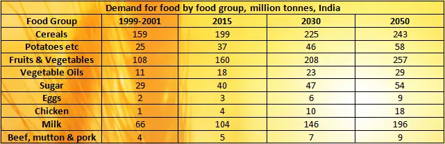
According to FAO Global Perspective Studies Unit, 2006 the projected food consumption levels in India from the current average level of about 2,400 kilocalories per capita per day will increase to about 3,000 kilocalories per day in 2050. By then, the population may stabilize at 1.69 billion (FAOSAT). As is typical of countries with rising incomes, the share of calories derived from cereals is declining in India and is projected to fall below 50% by 2050. The projected demand for cereals (for direct human consumption) is projected to rise from 159 million metric tonnes in 1999-2001 to 243 million tonnes in 2050, an increase of 53 percent, or 0.9 per year (Table 1). The high and increasing population pressure notwithstanding the slowdown in productivity growth has aggravated the household and individual level (micro-level) food insecurities.
There are many areas where farming is still done the traditional way, and there are also numerous hi-tech farms. Issues such as drought, lack of irrigation facilities, low productivity, and paucity of funds plague Indian agriculture. The government has been making concerted efforts to improve the agricultural scenario in India. Agricultural insurance schemes have been launched, subsidies are being given for digging wells and purchasing agricultural equipment, and crop insurance schemes have also been introduced.
Since land cannot be extended horizontally and with the already overburdened planet in fact with no more arable land or fresh water to spare it is hard to meet the food and feed demand in 2050. There is an urgent need for new scientific ideas and experiments with traditional farming to sustain the present National Food Security Act 2013. Until 1967 the government largely concentrated on expanding the farming areas. But the population is growing at a much faster rate than food production. This called for an immediate and drastic action to increase yield.
The practice of double cropping, use of high yield variety (HYV), fertilizers along with the use of geospatial technology can bring another green revolution in India.
Use of geospatial technologies in Indian agriculture
Geospatial technologies can play a significant role in overcoming some of these constraints. They can help in assessing soil health, land use and crop mapping, yield forecasting, identifying potential agricultural zones, etc. By helping help Indian farmers make more efficient use of their land and boost agricultural production.
The concept of precision farming or agriculture utilizes geospatial technology and information for optimal, minimal, and suitable use of available resources for maximum outputs from the farms. The world has understood the importance of precision farming and come together as a global body and has pledged to ensure food security in developing countries through the g-powered initiatives.
There are various organizations and agencies in the world like the World Bank, Food and Agriculture Organization (FAO), World Food Programme (WFP), Asian Development Bank (ADB), European Commission which came up together long ago to bridge the feed and food demand in 2050.
The concept of precision farming concept enables farmers to visualize their land, present, and future condition of their crop and management practices through modern technologies like remote sensing, GIS, GPS, UAVs, and mobile apps. These tools and techniques can be used in various aspects.
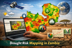
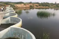
GPS and GIS can be used in the evaluation of farmer field topography, mapping, drainage layout, plot layout, parcel mapping to ensure correct drainage for minimum irrigation and minimum cost. Precision weather forecasting is another major challenge in agriculture. The use of remote sensing technology with various modeling methods could provide the present and future trends of change in the climate. A good example of this is the drought prediction model of the United States Drought Monitor.
With the precise positioning ability of advanced GPS receivers’ seeds can be placed in exact numbers in the exact location with the required depth. This will reduce the seed cost, better germination, and high-quality production.
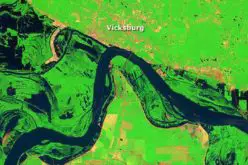
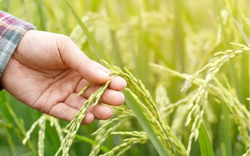
Remote sensing technology is very useful in monitoring crop health. With the availability of temporal datasets, remote sensing can be used to monitor the crop and vegetation through spectral analysis and various vegetation indices. Remote sensing is also being a source to monitor the water stress condition of the crop. The availability of various products like land surface temperature is very useful to study vegetation. With the advancement of sensor technologies’ high spatial and spectral resolution, data can be used in precise crop monitoring. Data of Hyperspectral remote sensing can be used in soil profiling based on the availability of nitrogen.
With the advancement in mobile technology mobile apps are available for real-time information access like the IWMI-Data (this app gives free access to online data of the International Water Management Institute) and the Connected Farm app by Trimble allows better decision making.
Unmanned Aerial Vehicle (UAV) or Unmanned Aerial System (UAS) has tremendous application in agriculture. A recent study has soon that UAVs can be used in weed mapping and control. Images from onboard high-resolution multispectral sensors, hyperspectral and thermal sensors of UAV have application in seed snowing, pesticide spray, herbicides spray, crop health monitoring, decease monitoring, and harvesting.
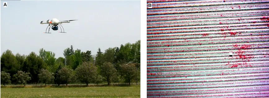
Source: Weed Mapping in Early-Season Maize Fields Using Object-Based Analysis of Unmanned Aerial Vehicle (UAV) Images by José Manuel Peña et. al..
In a developing country like India, where agriculture has a major share in the GDP, the need for precision farming is more demanding. Agriculture remains the largest employment sector in India and farm sizes are typically small and precision agriculture is yet to take off since the technology is not affordable. The policy-maker has understood the need for geospatial technologies in bringing another green revolution and the Government of India recommended the use of remote sensing, GIS, and GPS-based decision support system. There are various projects are running across the various scientific organizations in India.
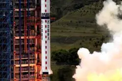
Other organizations such as the Indian Space Research Organization (ISRO), International Crops Research Institute for the Semi-Arid-Tropics (ICRISAT), Hyderabad, and Regional Remote sensing centers (RSAC) has found agriculture as the thrust area in a remote sensing application program in India. In fact, ISRO has started cropping forecasting in the late 1980s.
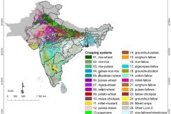
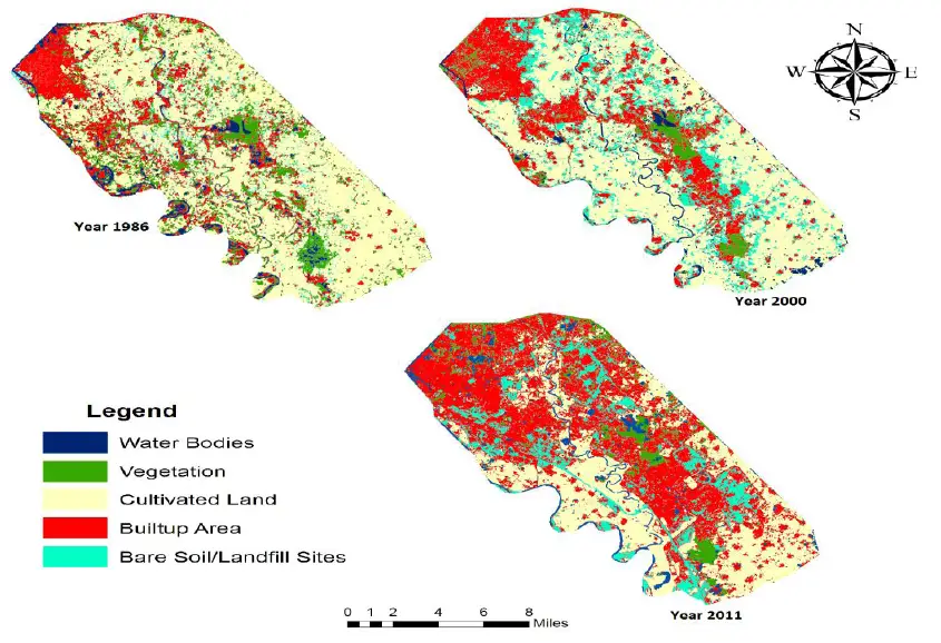
The swift diversion of cultivated land for non-agricultural purposes is currently a matter of great concern. The focus of LCLUC research is on quantifying the location, extent, and variability of change, the causes or forcing factors of change, for example, climatic, ecological, and socioeconomic drivers, the processes of change, and the responses and consequences of change. The study of land use and land cover using geospatial technology serves as a planning and guidance tool for policy-makers.
The rapid development and integration of spatial technologies such as Geographic Information Systems, the Global Positioning System, and remote sensing, have created many new horizons and tools to explore by professionals, but have also widened the “digital divide,” leaving many with little understanding of the technology and potential applications. Another issue related to the effective implementation of geospatial technology is the integration of these modern techniques with the local knowledge systems.
The role of government, NGOs, and developed countries can play a vital role in narrowing the digital divide. Government and private partnership, subsidies in the procurement of modern tools and techniques, ground implementation, educating, and creating awareness about the importance of geospatial technologies can make the successful implementation of geospatial technology in India for sustainable agriculture production and bringing new green revolution.
Benefits of using geospatial technologies in bringing another green revolution in India
Geospatial technologies use spatial analysis and mapping to understand relationships between physical features and human activities. In general, geospatial technologies can help address several problems such as low productivity, inadequate irrigation, crop insurance, drought monitoring, whether predication, crop yield estimation, crop disease identification, crop health monitoring, etc. and improve the productivity of Indian agriculture.
However, the following are some of the benefits that can be derived from the use of geospatial technologies in Indian agriculture:
- Land use mapping can help to identify areas that are suitable for agriculture and those that are not. This can help to optimize the use of land and reduce wastage.
- Crop mapping can help to improve yields by providing information on the location and stage of the crop.
- Crop health monitoring and yield prediction.
- Drought monitoring and drought mitigations.
- Soil health monitoring to suggest the requirements of fertilizers and irrigation.
- They can help with precision farming by providing information on where to place fertilizer, water, and other inputs.
- They can help identify areas that are prone to erosion or flooding.
- They can help track the spread of pests and diseases.
- They can help map out farmlands and track the growth of crops.
- They can help with land management and planning.
Conclusion
Geospatial technologies are becoming more and more important in agriculture, helping farmers to make better decisions about where to plant crops, how to irrigate them, and when to harvest. The article covered various technologies, schemes, and projects where Geospatial technologies can help bring about a new green revolution in India.
With the numerous success stories around the world in the field of remote sensing, GIS, and GPS implementation, the resolution of precise farming could pave way for India to meet the food and feed the demand of 2050 and hence bringing another green revolution.
If you’re interested in learning more about geospatial technologies in bringing another green revolution, please follow our blog for future updates, and read the GIS Resources magazine on “Geospatial Technologies for Sustainable Agriculture Development”.