Airborne LiDAR Datasets Covering Two Volcanic Fields and a River Confluence
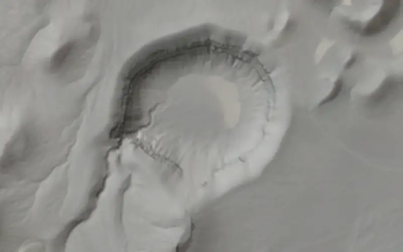
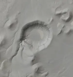
Hillshade image with slight transparency to show Google Earth imagery of the Lunar Crater Volcanic Field, Nevada.
OpenTopography is pleased to announce the release of three new LiDAR datasets covering two volcanic fields in Northern Arizona and Nevada as well as a river confluence in Colorado. The Sunset Crater Volcanic National Monument data were funded by the National Parks Service and the Nevada and Colorado datasets were funded by the National Science Foundation and collected by the National Center for Airborne Laser Mapping (NCALM).
NCALM Data:
Both the Lunar Crater Volcanic field, NV and Colorado data were NSF projects collected by NCALM. NCALM is a NSF-funded center that supports the use of airborne laser mapping technology (a.k.a. lidar) in the scientific community and is jointly operated by the Department of Civil & Environmental Engineering, Cullen College of Engineering, University of Houston and the Department of Earth and Planetary Science, University of California, Berkeley. The release of these data via OpenTopography is the product of a memorandum of understanding (MOU) between OpenTopography and NCALM to make OT the primary distribution pathway for NCALM data. Both datasets were collected in 2012.
NPS Data:
The National Parks service funded the collection of airborne lidar data over the Sunset Crater Volcano National Monument in Northern Arizona. This lidar was collected for the National Park Service because they require a high-resolution digital elevation model to serve as a base layer for further inventory and monitoring of Sunset Crater Volcano’s unique resources. The objective of this procurement was to acquire a high-resolution bare-earth digital elevation models (DEM) of Sunset Crater and adjacent areas around the park.
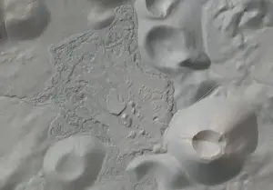
Hillshade image with slight transparency showing Sunset Crater National Monument, Arizona