Smart Cartography: “Six Examples of How Old-fashioned Navigation Aids Have Been Transformed into Today’s Smart Maps”
SMART CARTOGRAPHY: Six examples of how old-fashioned navigation aids have been transformed into today’s smart maps
 Berlin, Germany 25, April 2017 | The 65th Cartography Conference run by the German Society for Cartography (DGfK) in 2017 is dedicated to smart cartography. At INTERGEO 2017, the community is showcasing its credentials as an innovative scientific discipline that excels in the digital representation of the environment and setting new accents with its smart maps.
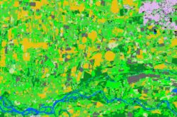
The latest smart maps are as far removed from their 2D relations on paper as is the state-of-the-art GIS platform from the analogue planning basics of bygone years. But just what is so smart about these cutting-edge maps? Here’s a handful of examples of smart cartography.
1. Smart maps are intuitive and attractive
Maps have always been used to represent relationships and make sense of our surroundings. More often than not, they achieve this far better these days than ever before. Maps have become more accessible to their target groups and more intuitively understandable. You rarely need instructions on how to read a map nowadays. A prime example of innovative design is the widely discussed and highly praised new plan of Berlin’s public transport network. Architect Jug Cerovic uses his own special standard to translate complex public transport systems into both functional and aesthetically appealing maps. (http://www.jugcerovic.com/
2. Smart maps provide customized information
Smart maps provide customized information right where it is needed. This might be the optimum route for mountain bikers or hobby cyclists (www.bikemap.net) or for navigating stress-free through the city using whichever mode of transport you like (https://wego.here.com/). While in the past, maps flattened reality into 2D, nowadays 3D is the norm. Not only that, but the fourth dimension of time is becoming increasingly prominent in digital maps. (http://360.here.com/2017/03/
3. Smart maps capture the moment – right now
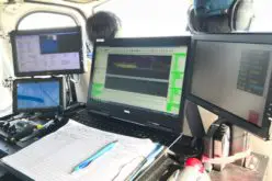
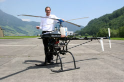
Today’s smart maps are a dynamic product. They don’t lead to dead-ends, but instead simply keep on evolving. In the Internet of Things, where vehicles, mobile objects and sensor data gather and network millions of items of information, companies are working on creating living maps that constantly display real-time status. These form the basis for the self-driving vehicles of the future, on the streets and in the air close overhead. (https://here.com/en)
4. Smart maps reveal new insights
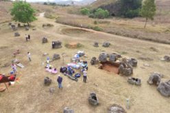
Whether you’re interested in commuter flows or refugee accommodation (https://www.findingplaces.
5. Multi-sensory maps
Acoustic maps have been able for some time to visually represent “soundscapes” or add sound with the aid of audio files (http://www.life-dynamap.eu/). What’s new is the addition of olfactory elements. Researchers at Goodcitylife are working on capturing the “smellscape” of cities. And their Happymaps offer a completely new slant on the city – for those who are not as much bothered about getting from A to B as “enjoying the ride”. (http://goodcitylife.org/
6. Virtual and augmented reality
No one can fail to have noticed the craze whipped up by the AR application Pokémon Go (http://www.pokemongo.com/de-
Smart Cartography is the top theme at the 65th Cartography Conference, which will take place from 26 to 28 September 2017 as part of INTERGEO in Berlin. Numerous examples at the conference and trade fair will reveal smart cartography’s wealth of potential.
About INTERGEO
INTERGEO, which consists of a conference and a trade fair, is the world’s largest event for geodesy, geoinformation and land management. It is held every year at different venues in Germany. The conference, which has around 1,300 participants, deals with current issues from politics, administration, science and industry. At last year’s leading trade fair, more than 17,000 visitors discovered the latest innovations from 531 companies from 37 different countries. Visitor, exhibitor and exhibition area statistics for INTERGEO are calculated and certified in line with the standardised definitions of the FKM (Society for the Voluntary Control of Fair and Exhibition Statistics).
INTERGEO’s aim is to facilitate process optimisation in numerous target markets with the geo-IT potential it showcases. Its forthcoming venues are the internationally renowned exhibition cities of Berlin in 2017, Frankfurt in 2018 and Stuttgart in 2019.
INTERGEO is hosted by DVW – the German Society for Geodesy, Geoinformation and Land Management.
Further information is available at http://dkk.dgfk.net/, www.intergeo.de
Relevant interviews and video clips can be found at www.intergeo-tv.com