
Tag "3D Elevation"
Software
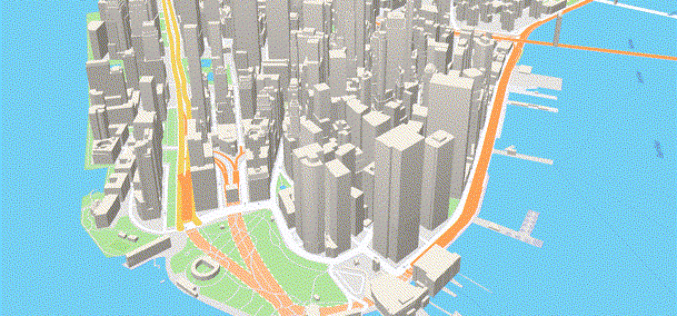
Mapbox Added 3D features in Mapbox GL JS
Mapbox added 3D features to Mapbox GL JS to take your maps to new heights! With the new extrusion properties, we can render 3D buildings/3D visualizations, visualize elevation profiles, build
GIS
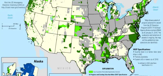
2016 Lidar Partnership Awards Announced
The U.S. Geological Survey has announced the first recipients of the 2016 partnership funding awards for the 3D Elevation Program. This program, referred to as 3DEP, presents a unique opportunity
