
Archive
New Maps Illuminate Monterey Bay Area Seafloor
Six new sets of maps reveal the diverse and complex range of seafloor habitats along 130 kilometers (80 miles) of the central California coast from the Monterey Peninsula north to Pigeon
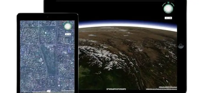
Meet HTML5 and the 3D Earth
HTML5 is the latest HyperText Markup Language of the World Wide Web Consortium (W3C), which was first published in 2008. However, it was released and has been used since 2011
Esri Showcases Smarter Decision Making through GIS at White House Water Summit
Esri is participating in the White House Water Summit, in celebration of the United Nations’ World Water Day. Esri has committed to building new technology that maps the extent and
Korea to Launch Spatial Data Infrastructure Building Projects in Central Asia, Africa
According to recent news by Business Korea, The National Geographic Information Institute (NGII) is planning to launch spatial data infrastructure (SDI) building projects in Kazakhstan, Kyrgyzstan, Uzbekistan and Mongolia. The

Esri Publishes the Workbook Getting to Know ArcGIS Pro
Learn to Use Esri’s ArcGIS Pro and Start Making Informative 2D and 3D Web Maps The new workbook Getting to Know ArcGIS Pro teaches the fundamentals of making 2D and
NASA Training: Earth Observations, Data and Tools for Air Quality Applications
NASA Earth Observations, Data and Tools for Air Quality Applications 28-29 August 2016, 9:00 a.m. – 5:00 p.m. KST (GMT+9) Pusan National University, Busan, South Korea The goal of the
2016 Doug D. Nebert NSDI Champion of the Year Award
The Federal Geographic Data Committee is now accepting nominations for the Doug D. Nebert National Spatial Data Infrastructure (NSDI) Champion of the Year Award. Doug was a recognized national and international
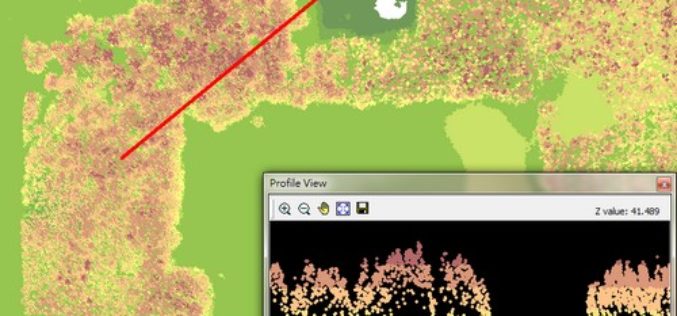
Put Your LiDAR Data on the GIS Platform!
By rapidly collecting massive data from the surface, LiDAR technology has dramatically changed the geospatial industry. LiDAR data can record much information delicately such as the elevation, the spectrum, and
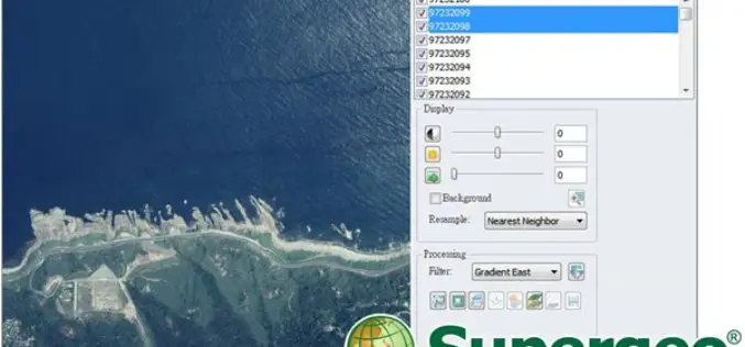
Experience Super Easy Raster Data Processing with a Single Click
Supergeo has added the Image Analyzer on the upcoming SuperGIS Desktop 10, which will provide greater convenience for GIS users to process raster data. Image Analyzer can integrate raster data
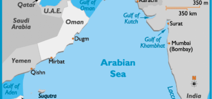
Ocean Acidification Observed in Arabian Sea
The Arabian Sea, cradling a diversity of marine habitats including coral reefs, is witnessing acidification of its surface waters, a consequence of excessive carbon dioxide in the atmosphere, say Indian
