
Tag "Automated Mapping of Landslide Events"
GIS
IIT Delhi Develops Tool for Automated Mapping of Landslide Events
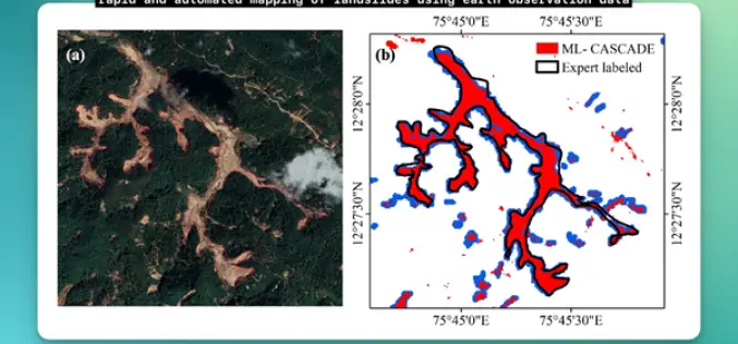
Researchers from the Civil Engineering Department at IIT Delhi have introduced a groundbreaking tool, ML-CASCADE, aimed at Automated Mapping of Landslide extents using satellite data. This cloud-based machine learning tool
