
Tag "GPM Microwave Imager"
GIS Data
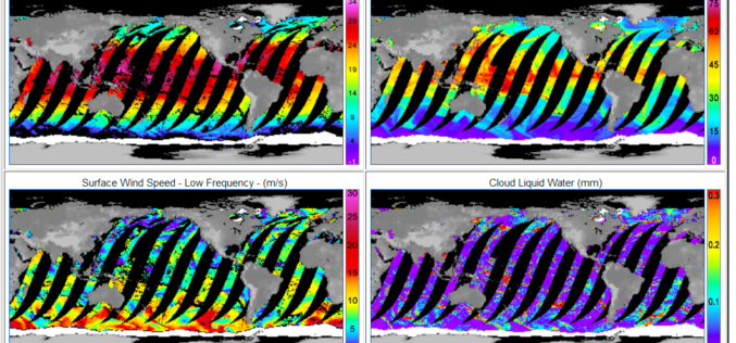
GPM Microwave Imager Data Products are Now Available to Download
Remote Sensing Systems has just released the GPM Microwave Imager (GMI) ocean product suite. The Global Precipitation Measurement (GPM) satellite has a microwave radiometer onboard called GMI (GPM Microwave Imager). The
Remote Sensing
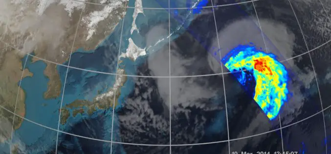
First Images Available from NASA-JAXA Global Rain and Snowfall Satellite
NASA and the Japan Aerospace Exploration Agency (JAXA) have released the first images captured by their newest Earth-observing satellite, the Global Precipitation Measurement (GPM) Core Observatory, which launched into space
