
Tag "Hazard Mapping"
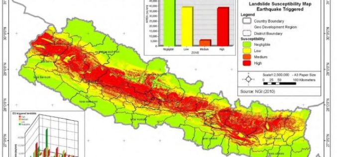
Nepal: Pilot Project on Landslide Hazard Mapping
Kathmandu – According to recent news by The Himalayan Times, the Department of Soil Conservation and Watershed Management, Nepal has started a pilot project of landslide hazard mapping from Dolakha
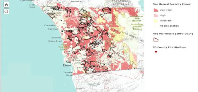
San Diego County Launch Web Based Wildfire Hazard Map Tool
Fire is a constant threat in San Diego County, and drought, high temperatures in the summer and fall, combined with seasonal Santa Ana winds can led to explosive fire growth.

Philippine Use LiDAR to Maps out Renewable Energy Resources
The Department of Science and Technology (DOST), Government of Philippine for applications of its Light Detection and Ranging (LiDAR) technology and maps out possible renewable energy resources through the PhiLiDAR

FEMA Release Guidelines for Coastal Flood Hazard Analysis and Mapping
The U.S. Federal Emergency Management Agency has issued Guidelines for Coastal Flood Hazard Analysis and Mapping for the Pacific Coast of the United States. FEMA’s mission is to support citizens and
