
Tag "Mobile Mapping system"

LiDAR
Leica Pegasus TRK Reality Capture Mobile Mapping System with AI and Autonomous Workflows
The Leica Pegasus TRK Reality Capture Mobile Mapping System is the latest advancement in reality capture technology. Leica’s Pegasus has been on the market for a few years, but this

Business
New Indoor Mobile Mapping System from NavVis Marks Breakthrough in Data Quality
NavVis M6 is a next-generation indoor mobile mapping system designed to overcome the scale and quality constraints of today’s reality capture technology April 18, 2018 – NavVis, a global leader in mobile
Business
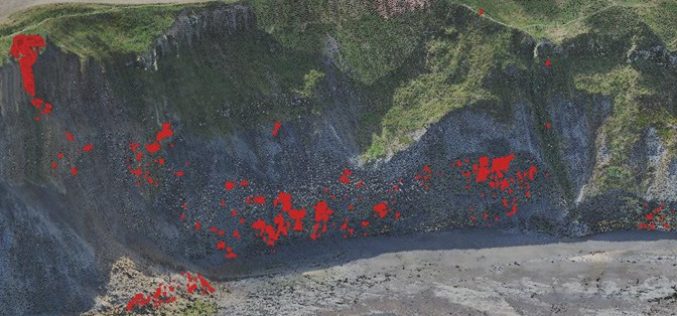
Monitoring Coastal Instability using Airborne and Terrestrial LiDAR
Unstable and rapidly eroding coastlines can cause risk to local infrastructure, and as such, it is important to gain a deeper insight and knowledge into the exact movements and erosion
