
Tag "Moderate Resolution Imaging Spectroradiometer (MODIS)"
Research Papers
Regional Equivalent Water Thickness Modeling from Remote Sensing across a Tree Cover/ LAI Gradient in Mediterranean Forests of Northern Tunisia
Regional Equivalent Water Thickness Modeling from Remote Sensing across a Tree Cover/LAI Gradient in Mediterranean Forests of Northern Tunisia – Hedia Chakroun, Florent Mouillot and Abdelaziz Hamdi Abstract: The performance of
Remote Sensing
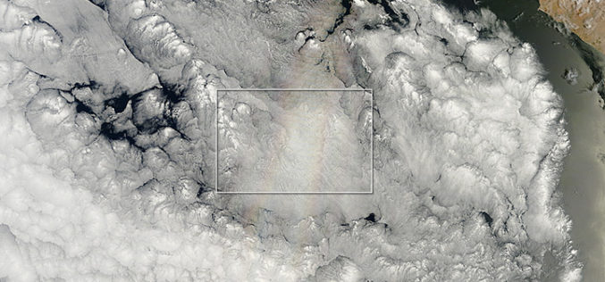
The Glory of the New Year
On December 21, 2013—the summer or winter solstice, depending on your hemisphere—the Moderate Resolution Imaging Spectroradiometer (MODIS) on NASA’s Terra satellite acquired this natural-color image. Off the Pacific coast of Peru, a
