
Archive

PCI Geomatics Implements Support for KazEOSat-1
MARKHAM, Ontario, Canada—February 25, 2015: PCI Geomatics, a world leading developer of remote sensing and photogrammetric software and systems, announced today that it has implemented support for KazEOSat-1, an Earth
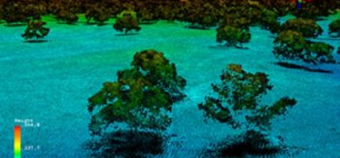
Full Waveform LiDAR Sample Data Now Available For Free
In a recent announcement by NEON, NEON Airborne Observation Platform (AOP) sample data is now available on the Airborne Data page. The NEON Airborne Observation Platform (AOP) is an aircraft

Ordnance Survey to Open Hub Dedicated to Innovation
In a move that aims to energise innovation in the UK geospatial industry, Ordnance Survey is opening a London-based Geospatial Innovation Hub to attract new players, new visions, new thinking and

Railways to Digitize Mapping of Land Records to Counter Encroachment of Railways Land
The Union Railway Minister Shri Suresh Prabhakar Prabhu has said that encroachment on the Railway Land is a serious issue and to counter this, digitized mapping of land records has

IIT Roorkee Offering Ph.D Programme in Remote Sensing and GIS
The Institute IIT Roorkee, has completed 150th year of its existence in October 1996. On September 21, 2001, an Ordinance issued by the Government of India declared it as the

Airborne LiDAR to Find Clues of Inhabitants in Amazon River Basin
In recent news by Archaeology, European Research Council has funded an international project to search the Amazon River Basin for clues to the forest’s inhabitants for the past 3,000 years.

DigitalGlobe Announces Availability of 30 cm Satellite Imagery to All Customers
Higher Resolution Satellite Imagery Now a Highly Competitive Alternative to Aerial Imagery for Global Applications LONGMONT, Colo.–(BUSINESS WIRE)–Feb. 25, 2015– DigitalGlobe, Inc. (NYSE: DGI), a leading global provider of high-resolution earth
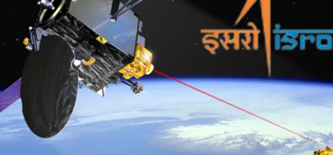
27 Indian Satellites Currently Operational: Govt
25 Feb. 2015 – As many as 27 satellites, including 11 which facilitate the communication network in the country, are currently operational and one more is to be launched next
New Stable Version of GRASS GIS 7.0.0 is Released
After many years of development the new stable major release GRASS GIS 7.0.0 is available. The graphical user interface based on wxPython has been enriched with many new features in

Webinar: AirGon Presents small UAS Metric Mapping Workflows
AirGon Presents small UAS Metric Mapping Workflows Wed, Mar 4, 2015 2:00 PM – 3:00 PM CST In this webinar we will be taking a look at a complete workflow
