
Tag "Satellite Geodesy"
Geodesy
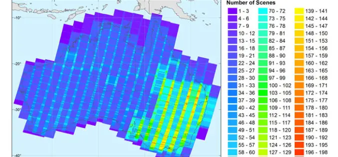
New Open-source Software Enhances Satellite Geodesy Capability
Scientists from Geoscience Australia have released new software that will improve the ability to process big remotely-sensed satellite datasets. The new “PyRate” software being presented this week at the European
Surveying
What is Geodesy?
What is Geodesy? Geodesy is the science which deals with the methods of precise measurements of elements of the surface of the earth and their treatment for the determination of
