
Tag "StreetMapper"
Business
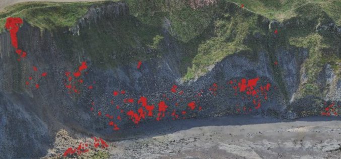
Monitoring Coastal Instability using Airborne and Terrestrial LiDAR
Unstable and rapidly eroding coastlines can cause risk to local infrastructure, and as such, it is important to gain a deeper insight and knowledge into the exact movements and erosion

Business
3D Laser Mapping Continue to Lead the Way With Mobile Mapping
It’s hard to believe that Mobile Mapping Systems (MMS) have been on the market for over a decade. 3D Laser Mapping was one of the first companies to create a

Business
GIS
StreetMapper First for Australia
Surveying company Whelans has purchased Australia’s first StreetMapper mobile laser scanning system from 3D Laser Mapping. Whelans purchased the system, which uses vehicle mounted lasers to capture highly
