
Tag "Terrestrial Laser Scanner"

RIEGL’s Ultimate LiDAR Technology New Products Launch at INTERGEO 2024
RIEGL’s Ultimate LiDARTM Technology offers a wide range of performance characteristics and serves as a platform for continuing Innovation in 3D for the LiDAR industry. New products, that will be

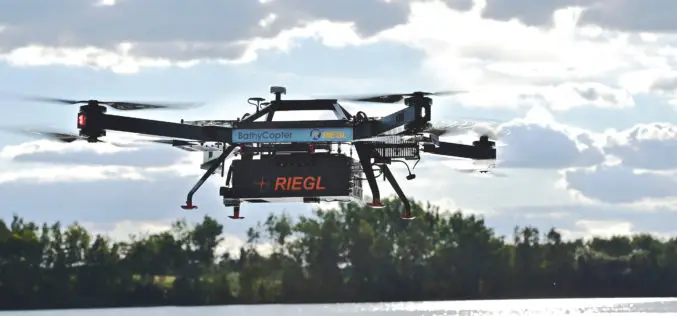
Introducing Polaris – Next-Generation Terrestrial Laser Scanner
Teledyne Optech to showcase its newest and most advanced TLS at SPAR 3D March 22, 2017 — Teledyne Optech is pleased to announce the release of its Polaris Terrestrial Laser
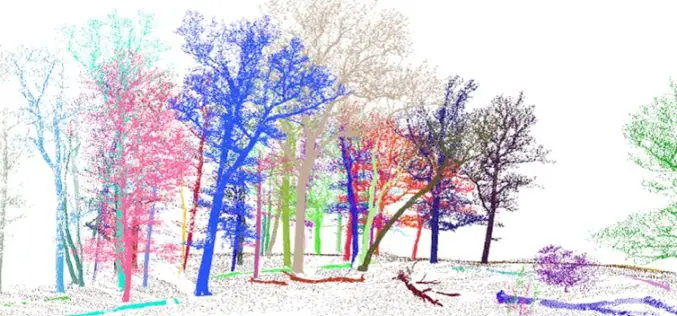
3D Forest – Forest LiDAR Data Processing Tool
Tool for point cloud data processing from forest environment acquired by terrestrial laser scanner (TLS) 3D Forest is an open-source software application for LiDAR data segmentation, visualization, and export of
RIEGL with Impressive Display at INTERGEO 2015 in Stuttgart
On the first day of INTERGEO RIEGL delivered an impressive display in Stuttgart! With a special UAV-area at booth E4.079, live demo UAV-flights at the outdoor area, and the unveiling
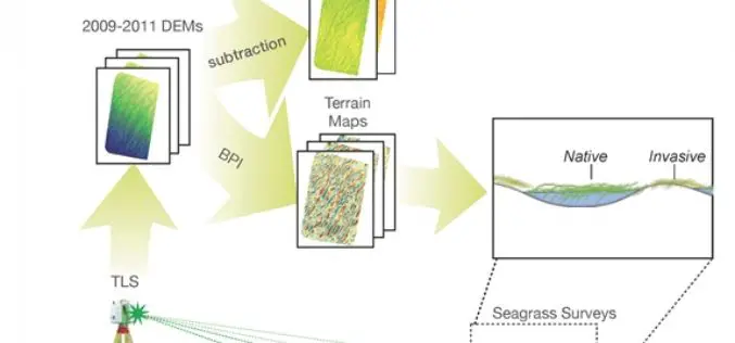
Terrestrial Laser Scanning Reveals Seagrass Microhabitat Structure on a Tideflat
Terrestrial Laser Scanning Reveals Seagrass Microhabitat Structure on a Tideflat – Michael Hannam and L. Monika Moskal Abstract: Local-scale environmental heterogeneity can provide microhabitats that influence the spatial distribution of competing species.
