
Tag "Transport and Tourism"
Software
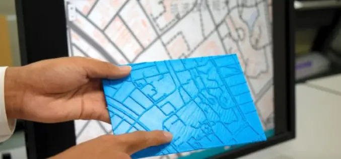
Visually Challenged Soon Have 3D Printed Maps
Recently in news, Japan’s cartographic authorities have announced that it has developed a software that allows users to download data from the internet and produce low cost geographical maps
