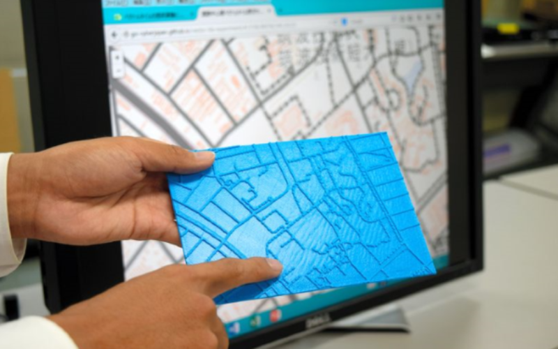
 Recently in news, Japan’s cartographic authorities have announced that it has developed a software that allows users to download data from the internet and produce low cost geographical maps of the country for the visually impaired using a 3D printer.
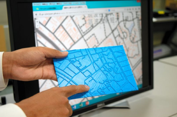
The Geospatial Information Authority of Japan (GSI), a department of the Ministry of Land, Infrastructure, Transport and Tourism, will work with experts from different regions on the development phase. This software will ensure that highways, walkways or railway lines are well-differentiated in the final product, reported Asahi daily this week.
The programme’s data will allow users to have 3D printed maps of streets having a height of one millimeter that can be easily detected with the fingers.
Tetsuya Watanabe, a professor at Niigata University who is participating in the creation of the software, explained that they also plan to introduce topographical features such as uneven surfaces and hills, so these maps could be used in courses for the blind focused on emergencies and earthquake- or tsunami-related evacuations.
Once the software is developed, all the cartographic data of Japan needed to create such maps will be available on the internet.
Maps for urban zones will have a scale of 1:2.5 (1 cm equals 25 m) while those of rural areas will be on the scale of 1:25 (1 cm equals 250 m). The maps will be printed using a desktop FDM 3D printer on resin sheets. The material for each plate measuring 15 x 15 cm cost just 150 yen ($1.40) per unit.
GSI explained that given the popularisation of 3D printers, it would also offer data in the future to develop maps of very specific places at prior request, and they will also study the level of detail for the maps and the use of Braille to make it easy for the visually impaired.
&bnsp;
Source: IANS