 Smart City, defined as utilizing digital technologies to trim costs and resource consumption to engage its citizens more effectively in various domains like transport, health care, energy, water, and so on, is a popular concept among modern governments around the world.
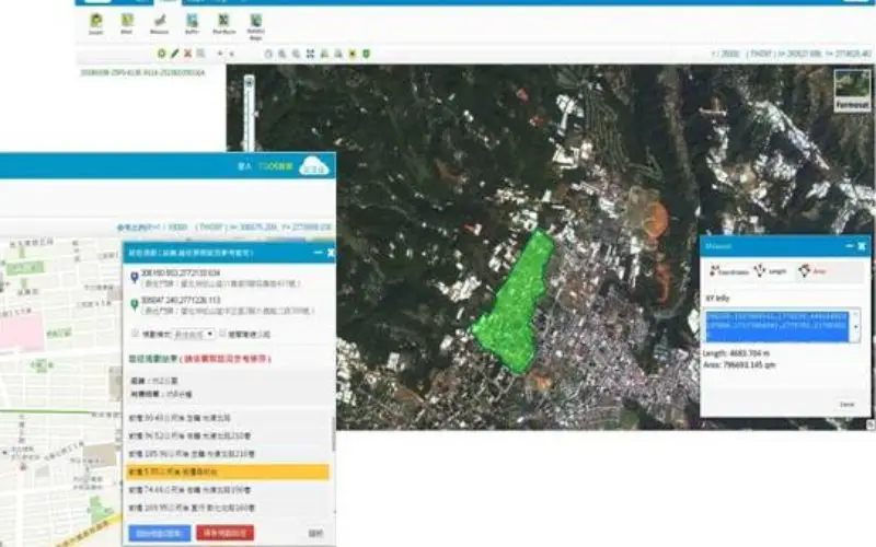
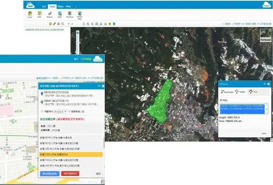
Catching the trend, Ministry of the Interior, Taiwan authorizes Supergeo to establish TGOS Cloud Service, Taiwan Geospatial One Stop portal, which provides diverse geospatial data and map APIs to share with all sectors and build map websites effortlessly.
The project utilizes SuperGIS Server 3.2 and SuperGIS 3D Earth Server 3.2, the enterprise server software, as core system, to integrate and publish distinct GIS services including thematic maps, geographical features query, OGC services, map APIs, etc. SuperGIS Server offers a scalable structure so that the whole server infrastructure can flexibly distribute services and resources on demand, saving more costs in a technically stable way.
Several public and private sectors have successfully applied the TGOS map services. For example, National Science and Technology Center for Disaster Reduction (NCDR) is an important sector for disaster control and response in Taiwan. By using TGOS maps, NCDR built its own disaster prevention map site, which integrates weather forecasts, flooding, mudslide, tsunami, emergency evacuation location information, etc. The GIS site provides the public with abundant resources to understand their own environment and make disaster prevention plan in advance.
In this year’s new development plan, TGOS project successfully develops 3D Map APIs, which not only fit the current TGOS service, such as location service and query, but also demonstrate geospatial data in a realistic way. Users can build their 3D geospatial sites quickly, in which the environment data like weather, transportation, and urban development can be well displayed and understood in real-world-like platform and help decision makers to access more comprehensive information for future planning.
Experience Enterprise Server: http://www.supergeotek.com/download_6_server.aspx
TGOS, Taiwan Geospatial One Stop: http://map.tgos.nat.gov.tw/TGOSCloud/Web/Map/TGOSViewer_Map.aspx
# # #
About Supergeo
Supergeo Technologies Inc. is a leading global provider of GIS software and solutions. Since the establishment, Supergeo has been dedicated to providing state-of-the-art geospatial technologies and comprehensive services for customers around the world. It is our vision to help users utilize geospatial technologies to create a better world.
Supergeo software and applications have been spread over the world to be the backbone of the world’s mapping and spatial analysis. Supergeo is the professional GIS vendor, providing GIS-related users with complete GIS solutions for desktop, mobile, server, and Internet platforms.
Marketing Contact:
Patty Chen
Supergeo Technologies Inc.
5F, No. 71, Sec. 1, Zhouzi St., Taipei, 114, TAIWAN
TEL:+886-2-2659 1899
Website: http://www.supergeotek.com
Email: patty@supergeotek.com