
Archive
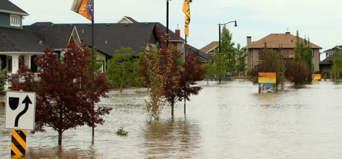
Fighting floods with GIS -based emergency response system
The New South Wales State Emergency Services (NSW) will have a new weapon this flood season after rolling out a high-tech mapping system that allows volunteers on the ground to

Apple’s 3D recording concept could allow user-generated ‘street views’ in Maps
On Tuesday, The U.S. Patent and Trademark Office awarded Three-Dimensional Model Using a Portable Electronic Device Recording, to Apple. Apple Insider first detailed the patent, when it was simply a

ADC WorldMap Releases Digital Atlas Version 7.0
ADC WorldMap, a leader in providing comprehensive, current, and seamless geographic digital data for the whole Earth, is pleased to announce the release of ADC WorldMap Digital Atlas v7.0.

KhalifaSat – The first UAE made satellite to be launched in 2017
KhalifaSat, the UAE’s first locally built satellite, is set to be launched into its orbit in 2017, said His Highness Shaikh Mohammad Bin Rashid Al Maktoum, Vice-President and Prime Minister

Odisha Mining Department asked to use Google Earth software
With the Justice MB Shah Commission of Enquiry indicting both the Odisha government and the Centre for illegal mining in the state, direction was given today to the mines
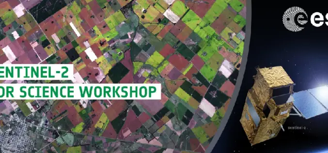
ESA-ESRIN is Hosting Sentinel-2 for Science Workshop
SENTINEL-2 for Science Workshop, 20-22 May 2014, Frascati, Italy The European Space Agency, in the context of the Scientific Exploitation of Operational Missions (SEOM) element, is organising an event dedicated to

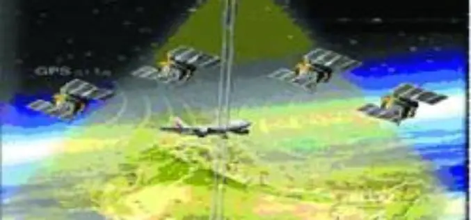
GPS System to Prevent Aircraft from Power Line Collisions
A team of scientists from Norwegian is working on a satellite based system to prevent helicopters and light aircraft from colliding with power lines and other obstacles. Collisions between
Ph.D. Admission in BIT Mesra, Ranchi
Applications are invited from interested candidates for admission to full-time / part- time Ph. D. programmes (Session Spring 2014) in the following Departments and Groups: (Please see Department web pages
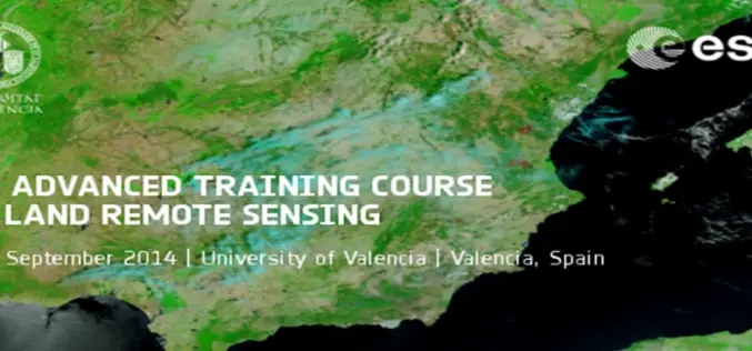
5th ESA Advanced Training Course on Land Remote Sensing
5th ESA Advanced Training Course on Land Remote Sensing : 8-12 September 2014, University of Valencia, Valencia, Spain As part of the Scientific Exploitation of Operational Missions (SEOM) programme element, the
GAGAN System Certified for RNP0.1 Operations
The Directorate General of Civil Aviation (DGCA), India has provisionally certified the ambitious Satellite Based Augmentation System (SBAS) programme of India – GPS Aided Geo Augmented Navigation (GAGAN) system
