
Archive
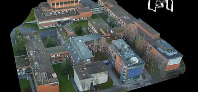
Drone That Can Create a Perfect 3D Map of Any Town – And May Help Set up 5G Networks
London, According to recent news reported by the PTI, Remote-controlled drones can be used to create an accurate 3D model of an urban area and design wireless networks, scientists say,
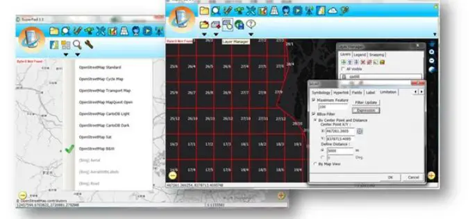
Collect High-Precision Data in the Field with latest SuperPad 3.3!
The global leading GIS software and solution provider, Supergeo Technologies Inc., is pleased to announce the latest release of SuperPad 3.3.4797. SuperPad is the mobile GIS software designed for surveying
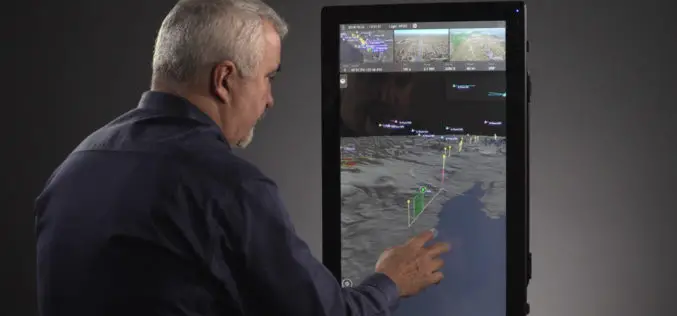
Kongsberg Geospatial & AirMap Deliver Real-Time Airspace Awareness and Tools for Drone Flight Beyond Visual Line of Sight
Ottawa, CA: Kongsberg Geospatial, an Ottawa-based developer of real-time, mission critical, geospatial visualisation software, and AirMap, the leading airspace management platform for drones, announced today that they will be delivering
Esri Boosts Higher Education in Ethiopia
Company Donates Cloud-Based GIS Solutions to More Than 30 Schools Redlands, California—Smart mapping leader Esri announced an agreement between Esri Eastern Africa Limited and the Federal Democratic Republic of Ethiopia

Election Commission of Malaysia Selects SuperSurv for Efficient Spatial Data Collection
Supergeo is delighted to announce that with the assistance from Supergeo’s partner in Malaysia, Suruhanjaya Pilihan Raya Malaysia (SPR Malaysia, lit. Election Commission of Malaysia) has recently chosen SuperSurv 3.3 as the

Webinar on Leveraging the AWS Cloud for Local Government GIS
Timmons Group Announces Webinar on Leveraging the AWS Cloud for Local Government GIS Fri, Nov 18, 2016 12:30 AM – 1:30 AM IST Show in My Time Zone Timmons Group,

Introducing TerraSmart’s New Fleet of High Precision Aerial Site Mapping Drones
High-Precision Aerial Site Mapping Drones Streamlines Site Topography for Faster and More Profitable Solar TerraSmart proves once more that autonomous technology brings increased precision, speed and cost-savings to the
Esri Maps the Way to a More Connected World at IoT West
Telecom Expert Explores the Ways Location Forms the Missing Link in the IoT Ecosystem Redlands, California—Global smart-mapping leader Esri today announced that telecom executive Randy Frantz will be featured at
TerraGo Webinar: Connect your ArcGIS with the Edge of the Enterprise
Webinar: Connect your ArcGIS with the Edge of the Enterprise November 15, 2016 | 12:00 PM (ET) Maximize your ArcGIS investment and reach a wider mobile audience, while improving field data

USDA Funds Bodkin Design to Develop UAV Sensor for Precision Agriculture
Bodkin Design & Engineering, LLC has been awarded a $100,000 contract from the U.S. Department of Agriculture (USDA) to develop a compact hyperspectral imager for UAV platforms. This unique camera
