Webinar: Connect your ArcGIS with the Edge of the Enterprise
November 15, 2016 | 12:00 PM (ET)
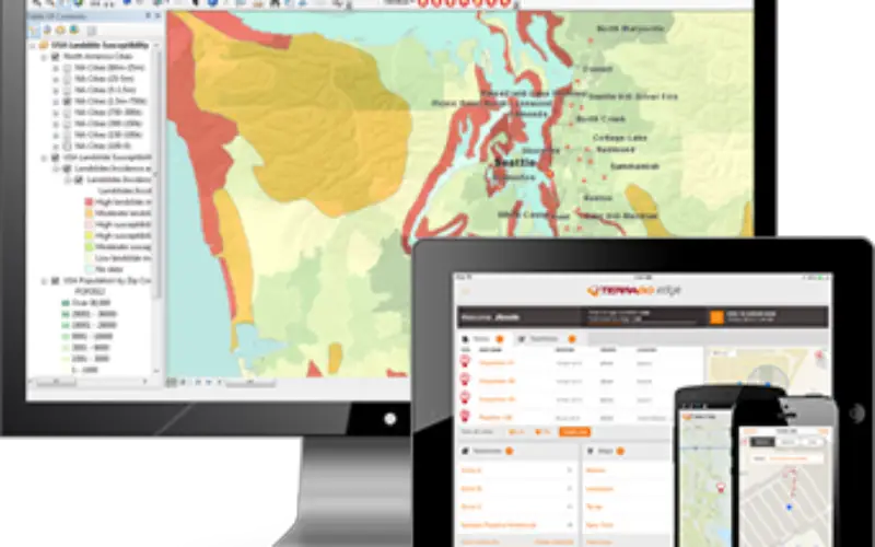
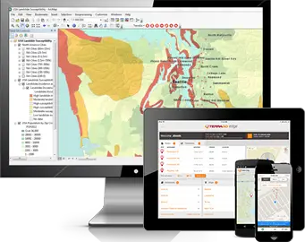 Maximize your ArcGIS investment and reach a wider mobile audience, while improving field data integrity and workforce management with TerraGo Edge. Designed to be an open platform, TerraGo Edge offers the ability to integrate and extend your existing enterprise platforms, while also providing the flexibility to collaborate with a diverse audience from the GIS analyst to the mobile field user. Join this webinar and learn more about integrating TerraGo Edge and ArcGIS to:
-
style="text-align: justify;">Access ArcGIS Online base maps and imagery from an easy-to-use mobile app on iOS and Android;
- Create custom basemaps with overlays from ArcGIS and use them offline from any location;
- Collect field data with mobile smart forms and keep working even without a network connection;
- Get survey-grade accuracy with direct integration to Trimble® GNSS and other leading receivers;
- Seamlessly update ArcGIS features with data collected from TerraGo Edge;
- Automate field data collection workflows using REST API tools;
- Build custom, branded field data collection apps for ArcGIS with zero code;
- And much more…
Register Now
Categories:
Webinars
Tags:
arcgis, ESRI ArcGIS, geospatial, GIS, GIS Webinar, GNSS, TerraGo Edge, TerraGo Webinar, Trimble, Trimble GNSS, Webinar