
Archive
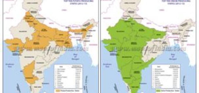
Agriculture Ministry Plans to Utilize Remote Sensing to Map Potato & Onion Cultivation Area
NEW DELHI: According to recent news by The Economic Times, the agriculture ministry is planning to use remote sensing technology to map the area under potato and onion cultivation for
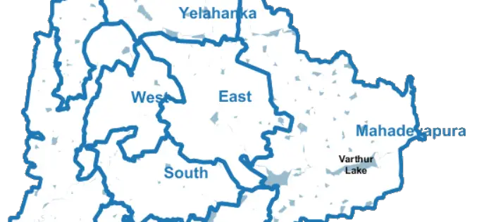
Bengaluru City to Have Geospatial Enabled Property Tax Information System
According to recent news by the Time of India, the online platform for property tax management has been set up by Bruhat Bengaluru Mahanagara Palike (BBMP) in association with the Indian

OGC Calls for Participation in its Indian Interoperability Plugfest
26 December 2016: The Open Geospatial Consortium (OGC®) is calling to vendors doing business in India for participation in its latest Interoperability Plugfest. The Department of Science and Technology (DST),

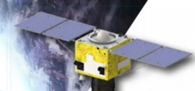
ImageSat International and Ben-Gurion University to Collaborate on Miniature Hyperspectral Imaging System
Technology based on university research could lead to new generation of spectral systems for flight and space-based remote sensing BEER-SHEVA, Israel…December 27, 2016 – ImageSat International (ISI) and Ben-Gurion University
China Launches SuperView-1 Duo High-resolution Remote Sensing Satellites
December 28, 2016 – China today successfully launched a pair of high-resolution remote sensing satellites to get commercial images. The satellites were launched today from the Taiyuan Satellite Launch Centre in
DGCA to Airlines: Use GAGAN or Face Consequence
Mumbai – According to recent news by the Mumbai Mirror, the government has warned domestic airlines of `consequences’ if they did not adopt the Rs 774 crore GPS-Aided Geo Augmented
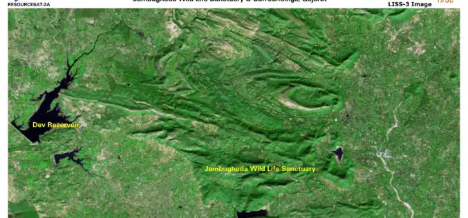
ISRO Releases First Day Images of RESOURCESAT-2A
RESOURCESAT-2A is a Remote Sensing satellite intended for resource monitoring. RESOURCESAT-2A was launched successfully by PSLV-C36 / on December 07, 2016 at 10:25 hrs (IST) from SDSC SHAR, Sriharikota. RESOURCESAT-2A is
Geological Survey of India Finds Huge Gold Deposits
Karnataka – According to recent news by the Deccan Herland, the Geological Survey of India (GSI) has found large gold deposits spread over 600 sq km between Shikaripur in Shivamogga

The Excellent Mobile GIS App – SuperSurv 10 Is Coming Soon
Supergeo is pleased to announce that SuperSurv, one of the most well-known mobile GIS products of Supergeo, will soon leap forward to the next generation, SuperSurv 10! Available on iOS

TerraGo Edge Version 3.9.8 Enhances Seamless Integration with Esri ArcGIS
New ArcGIS® Direct Connect feature added to ever-expanding ArcGIS integration options to easily exchange data between ArcGIS and TerraGo mobile data collection solutions Available today, TerraGo Edge version 3.9.8 now
