
Archive
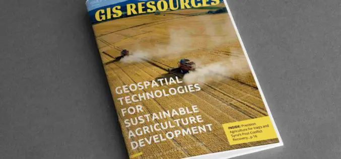
3rd Edition of GIS Resources Magazine: Geospatial Technologies for Sustainable Agriculture Development
GIS Resources Magazine (3rd Edition): Geospatial Technologies for Sustainable Agriculture Development Thanks for your interest and downloading GIS Resources Magazine – 3rd edition. Click to Download Thrid Edition – Geospatial Technologies
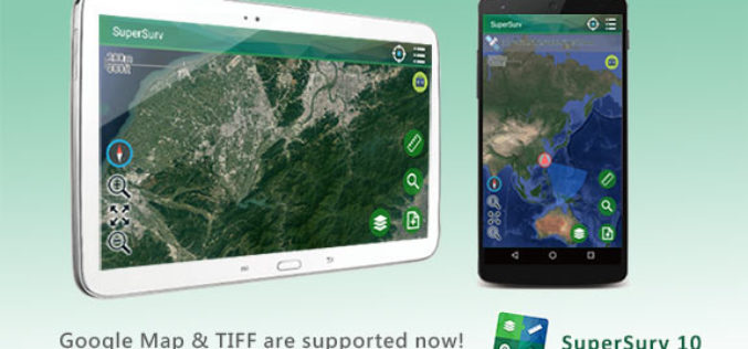
SuperSurv 10.1 Supports New Raster Formats and Online Maps
As the information technology constantly evolves, the geospatial industry also grows fast. Currently, including many open source projects, numerous services are providing online maps to geospatial professionals. As professional and
3D Stereo, Point Clouds, UAS, Virtual Reality and City Solar Solutions on Exhibit at INTERGEO
Anchorage, Alaska, USA. September 18, 2017 – Join DAT/EM Systems International® with co-exhibitors DAT/EM Systems Europe and RhinoTerrain™ SARL at INTERGEO from September 26-28 in Berlin, Germany. Booth visitors (C2.026 in Hall

FAA Works with Florida Drone Operators to Speed Hurricane Recovery
September 15–After the widespread devastation Hurricane Irma wreaked on Florida last weekend, unmanned aircraft – more popularly, drones – have been invaluable in supporting response and recovery efforts in the

Sustainable Agriculture Development using Geospatial Technologies
Most will be aware of the recent crisis that hit the Agriculture sector wherein despite a scenario of plentiful produce the individual farmer was in acute distress. Sound

Introducing Trimble Clarity – A Cloud-based Geospatial Data Viewer and Collaboration Product
Introducing Trimble Clarity – A Cloud-based Geospatial Data Viewer and Collaboration Product September 27, 2017 Join us live from the Intergeo Geospatial Conference in Berlin, Germany as we present Trimble
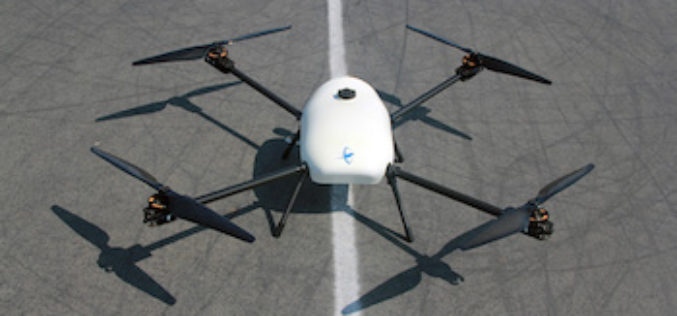
Skyfront Sets World Record for Drones with 4 Hour and 34 Minute Flight
Skyfront invents hybrid-electric drone technologies to enable monitoring of large, remote assets in challenging terrain for the Utility, Agriculture and Energy industries. MENLO PARK, CA, SEPT. 12, 2017 – Skyfront,

How Will Ag Technology Revolutionize Global Food Production?
How Will Ag Technology Revolutionize Global Food Production? Find out at the second annual PrecisionAg® Vision Conference Final Agenda delivers high-impact keynotes, track for specialty crops, Arizona field tour Willoughby,
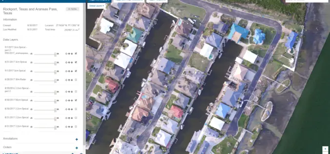
New Airbus Aerial Technology Impacts Hurricane Irma Recovery Efforts
September 12, 2017 – As residents and insurers in the southeastern United States begin to consider recovery efforts following Hurricane Irma, Airbus Aerial is prepared to help by providing insurance
PCI Geomatics Releases Geomatica 2017, Service Pack 1
MARKHAM, Ontario, Canada, September 12, 2017 – PCI Geomatics, a world leading developer of remote sensing and photogrammetric software and systems, announced today the release of Service Pack 1 for
