
Archive

US-Bahrain Geospatial Initiative Boosts Regional Security
The United States and Bahrain have embarked on a transformative partnership with the launch of the Geospatial Acceleration Initiative under the Comprehensive Security Integration and Prosperity Agreement (C-SIPA). This initiative

India-US Geospatial Alliance Boosts Trade Prospects
The India-US Geospatial Alliance has set an ambitious target to expand bilateral trade in geospatial technologies from the current $2.5 billion to $10 billion by 2030. This initiative aims to

Karnataka Adopts Satellite Forest Monitoring To Tackle Encroachments
In a groundbreaking move, Karnataka has introduced satellite surveillance to combat illegal forest encroachments, aiming to safeguard its green cover and ecological balance. This innovative system, known as the Forest
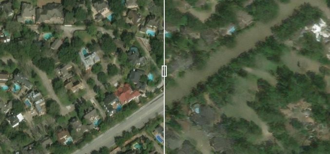
Predicting Flood Impacts with Generative AI and Physics-Based Models
Understanding the potential effects of hurricanes before they strike is crucial for helping residents prepare and take necessary actions, such as evacuation. Researchers at MIT have developed an innovative approach
