The Geospatial Development Program (GEO-DP) is an Engineer Regiment Program that leverages senior lieutenants/junior captains to provide additional officers to geospatial units while developing the officers’ geospatial skills, thereby increasing the geospatial competencies within the Engineer Regiment.
The Engineer Regiment offers two highly sought-after development programs, Technical Engineer Competency (TEC-DP) and Engineer Special Operations Forces (ENSOF-DP). For the Engineer Regiment, degreed engineers are about 50% of each year group. Those with engineering degrees tend to prefer TEC-DP as it allows them to apply their expertise in assisting a USACE district. For those who aspire to serve in elite units, ENSOF-DP offers the opportunity to act as a Special Forces assistant group engineer or assistant Ranger battalion engineer.
Organization
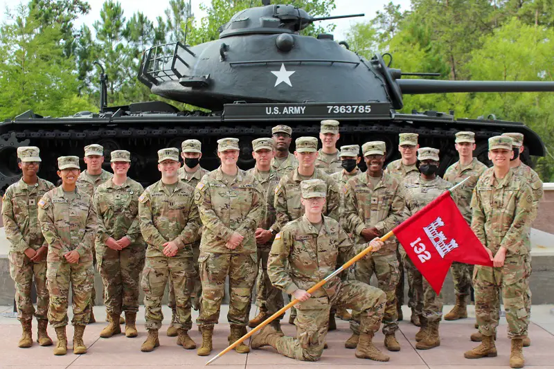
GEO-DP allows you to serve in one of the seven geospatial planning cells (GPCs): the 5th GPC aligned to USINDOPACOM at Fort Shafter, HI. the 60th GPC aligned to USEUCOM at Wiesbaden, GE, the 64th GPC aligned to USSOCOM at Fort Liberty, NC, the 132nd GPC aligned to USCENTCOM at Shaw Air Force Base, SC, the 512th GPC aligned to USSOUTHCOM at Joint Base San Antonio, TX, the 517th GPC aligned to USAFRICOM at Caserma Del Din, IT, or the 543rd GPC aligned to USNORTHCOM at Joint Base San Antonio, TX, the TRADOC Proponent Geospatial (TPO-GEO) office at Fort Leonard Wood, MO, or the National Geospatial-Intelligence Agency (NGA) in either Springfield, VA or Saint Louis, MO.
Each GPC is unique, and experiences will vary. At the 132nd, we had a MAJ, a MSG, a CW3 125D (Geospatial Engineering Technician), a CW2 125D, twenty-five 12Ys (Geospatial Engineers), a team of 5 contractors, and an NGA data steward.
My Background
2018, I was commissioned out of Texas Christian University as an Engineer Officer. My degree was in Biology, and my geospatial background was a single GIS class. I served as a sapper platoon leader and executive officer in the 54th BEB, 173rd IBCT (A), from January 2019 to June 2021. I didn’t even know my brigade had a GEOINT Cell until after I arrived at the 132nd. Openly, I didn’t choose GEO-DP because I was interested in the Army’s geospatial capabilities. I chose it because I wanted to reunite with my wife. At the time, she was a recruiting XO in Towson, MD.
Daily Life
The change from a sapper company to a GPC is jarring. They call working at an Army Service Component Command (ASCC) Army corporate. The hours are 0900-1700 and PT for E6s and above is on your own.
As the detachment XO, your role is like that of a company XO. You will be responsible for tracking maintenance, taskers, personnel actions, property, supply, and any other tasks assigned by the commander. However, the level of impact your unit has and the nature of the problems you face will be significantly different. Plans at ASCCs are made years in advance, presenting complex challenges that require long-term solutions. Quick fixes are rare, and you will work closely with your Chiefs to develop and implement systems that ensure the GPC can overcome any issues that arise. Creating a culture of problem-solving will require training and dedication from you and your Soldiers, but it is essential to staying on track toward success. The 12Ys work tirelessly to develop products that aid the ASCC and combatant command staff in decision-making. Their tireless efforts have a direct impact on the warfighter.
Keys to Success
As an officer, don’t focus on creating visually stunning products. Instead, it’s essential to understand the tools at your disposal and utilize them to their fullest potential. Your primary responsibility is to effectively convey how the GPC can benefit your commander and their staff.
It is important to acknowledge that you may have the least amount of knowledge about GIS in your detachment. However, don’t let this discourage you. Instead, challenge yourself to learn more. Start by understanding the difference between a raster and a vector and make it a habit to interact with your Soldiers and Warrant Officers every day. Warrant Officers are a valuable source of knowledge and expertise, so don’t hesitate to seek their advice. Remember to speak up if something is unclear, and don’t be afraid to ask questions, no matter how basic they may seem. As a leader, take the initiative to observe your Soldiers and their work to get a better understanding of how they accomplish their tasks.
Hone your skills through courses and TDYs. Enroll in NGA College (NGC) classes, namely Fundamentals of Geographic Information Systems, Intermediate GIS for Analysis, and the Geospatial Information and Services (GI&S) Officer Training Course (GOTC.) Most importantly, study for and pass the GEOINT Professional Certification (GPC) – Fundamentals and earn your W2 ASI (Geospatial Leader.)
Takeaways
I strongly recommend the GEO-DP program, but it is not for everyone. If you are a lieutenant who has already completed their platoon leader time and you want to continue to jump out of airplanes and blow things up, GEO-DP is not for you. However, if you enjoy being pushed out of your comfort zone and learning through immersion, GEO-DP is the perfect fit for you.
My GEO-DP time was rewarding. Not only was I able to increase my geospatial knowledge, but I got to meet and work with great people, I was able to learn and experience a relatively unknown part of the Engineer Regiment, and I had the privilege of becoming a Detachment Commander. Given the opportunity, I would do it again, and I implore any lieutenant to consider it.
Author By –
Troy Marshall,Engineer Captain,
GPC-FCPT,
ENECCC, PDP
Also Read –
5 Necessary Skills for a Successful GIS Career


