Keeping Up with the Times: Applying GIS Tools for Flood Disaster Mitigation
Author by – Glen Hartford Jr.
The natural world is becoming more unpredictable and our society needs to prepare for these changes. Whether these changes are human-generated or not, the 21st century is expected to have a significant increase in flood-related natural disasters, damaging buildings and residential properties. Global sea-level rise is expanding flood zones along every coast. River channels are migrating beyond what we can control. Temperature fluctuations are creating more vigorous storms than ever seen before. These disasters become even more challenging as different ecosystems and environments respond to flooding events differently from others.
However, Geographic Information System (GIS) related technology can identify areas more prone to flooding and water damage. Currently, GIS tools are often only used to assess and mitigate reoccurring floods after a natural flood disaster has already caused significant damages and restoration costs. To mitigate the severity of future damages, the government, private companies, and residential landowners should use GIS resources more proactively to prepare for flood-related events. A more successful flood disaster mitigation approach would not only save lives but reduce property damage and recovery costs resulting from these preventable catastrophic events.
Also, Read – GIS Resources Magazine – Geospatial Technology to Mitigate the Impact of Flooding
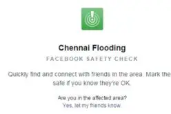
Using GIS as a tool for flood disaster mitigation is already a proven concept. The government has applied GIS technology in several ways to reduce disaster-related damages. These applications have been specifically helpful in flood emergency response and management, public help and safety, and environmental preservation. However, the government rarely uses these applications effectively as a pre-emptive measure to mitigate flood hazards.
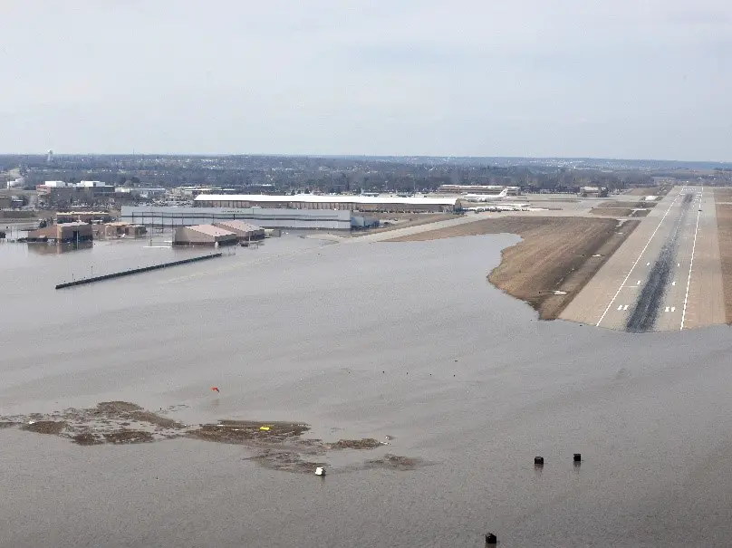
As an example, military installations and bases have suffered substantial flood damages within the last few years. The flood disaster at Offutt Air Force Base (2019) resulted in over $1.1 billion dollars of damages. These costs could have been avoided had a levee construction project, proposed in 2015, been completed along the Missouri River prior to the flood disaster. Including the estimated construction costs, the completion of this project would have saved the government over $1 billion dollars. A GIS analysis, combined with the local flood hazard zone data, would have identified some vital insight on the base’s property, such as flood susceptible zones, vulnerable buildings and structures, and locations for smaller, inexpensive projects that could have diverted surface water away from the base.
Also, Read – Open Source Satellite Images in Flood Monitoring. Do We Need a Liberal Spatial Data Policy During Disasters…?
In these scenarios, the government tends to be more reactive when planning for disaster-related events due to its size, limitations, and priorities. Understandably, it is impossible for the government to address all potential flood-related disasters across the United States. However, utilizing GIS more effectively could help predict major flooding events occurring near high-value property and assets. The decision to prolong the Missouri River levee construction project at Offutt Air Force Base proved to be devastating, yet this disaster could have been properly mitigated with simple GIS analysis.
Unlike the government, private companies tend to have more flexibility in mitigating flood-related damages because they own fewer assets in smaller geographic areas. More importantly, private companies tend to use GIS tools to execute their projects, including identifying construction zones, developing infrastructure plans, and conducting property environmental assessments. Engineering firms, environmental firms, construction companies, insurance companies, and utility companies are some examples of private companies that use GIS tools as a part of their everyday services. Flood-related GIS data can help private companies improve decisions influenced by flood-related zones before investing millions of dollars into projects.
Also, Read – Storm Water Modeling and Flood Disaster Mitigation and Management Using Open Source Software
It is important to recognize that private companies are motivated by profit and may use GIS tools to mislead clients and counterparts. One simple example would be an insurance company exaggerating the potential flood hazards on a property to increase their insurance rates. Another example may be a construction company using a cheaper geosynthetic liner around the building foundation, making the building more susceptible to water damage. As a potential customer, it is always important to verify these services are reliable and necessary. Although private companies may be providing accurate disaster-related recommendations, it can be useful for an individual to verify the information prior to compensating the company.
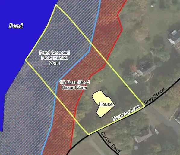
Finally, GIS could be an inexpensive, yet valuable tool for residential landowners to proactively protect their homes. Understanding local flood hazard zones, surface water elevations during the rainy seasons, or the relative groundwater depth can help property owners understand and mitigate flood-related risks and threats. An individual can utilize GIS resources to analyze this data and how their home may be vulnerable to flooding. QGIS, gVSIG, and GRASS GIS are examples of free software programs that allow users to make their own maps with color-coordinated symbols and shape features. Other resources like OpenStreetMap, NASA Earth Data, or FEMA’s Flood Insurance Rate Maps (FIRM) can help gather map and data files to construct flood hazard risk-oriented maps. If an owner uses GIS proactively and correctly, they can further mitigate flood-related damages by hiring contractors to construct drainage systems or build retention ponds that siphon water away from susceptible locations. GIS can be a simple and effective tool, regardless of the property size you are interested in protecting.
Also, Read – Philippines Uses LiDAR for Flood Hazard Mapping
GIS is a powerful resource as it is accessible, free, and relevant for multiple stakeholders. Anyone can use GIS software to develop flood disaster mitigation strategies and avoid high-cost, flood-related damages on their property. Most importantly, the government, private companies, and residential landowners all need to proactively use GIS to alleviate flood-related threats. The occurrence of flooding disasters is expected to drastically increase over the next century. As the world is changing around us, it is important for humans to adapt to it. We do not know how the world will look 100 years from now, but we need to start preparing for future flood-related disasters prior to them transpiring.
References: Hasemyer, David. “U.S. Military Knew Flood Risks at Offutt Air Force Base, but Didn’t Act in Time.” Inside Climate News, NBC News, 30 Nov. 2020, https://insideclimatenews.org/news/21032019/military-climate-change-flood-risk-offutt-air-force-base-army-corps-levee-failure/.