Call for Proposals for Geospatial Technology and Solutions: Impact and Importance for India’s Future
The National Geospatial Programme (NGP) division, formerly NRDMS, calls for proposals in Geospatial Technology and Solutions that have the potential to impact various sectors in India significantly. The National Geospatial Programme (NGP) advances geospatial science and technology to promote informed decision-making and sustainable socio-economic development.
Aligned with the National Geospatial Policy 2022, NGP seeks to make India a global geospatial leader by fostering stakeholder collaboration. NGP invites proposals for Geospatial Technology and Solutions, encouraging partnerships among academia, startups/MSMEs, industry, and practitioners. This initiative, emphasizing interdisciplinary collaboration, targets areas like agriculture, water resources, urban planning, environment, healthcare, disaster risk reduction, and logistics. The aim is to develop innovative solutions, strengthening the geospatial ecosystem and stimulating long-term socio-economic growth in India.
Here’s an analysis of the broad potential impacts and deep influence that the NGP’s call for proposals is expected to have across various domains, fostering a more technologically advanced, economically robust, and socially equitable India.
Economic Impact
- Commercialization of Innovations: The proposals aim to transform research outcomes into marketable products or services, fostering the growth of startups and MSMEs. This can lead to the creation of new businesses and job opportunities, boosting the economy.
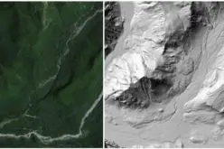
- Enhancing Agriculture: By implementing advanced geospatial technologies such as machine learning, SAR, and hyperspectral datasets, the initiative aims to improve crop health monitoring, yield estimation, and climate risk analysis, potentially increasing agricultural productivity and food security. Utilization of GNSS and NAVIC technologies will improve precision agriculture practices. This includes accurate land measurement, crop health monitoring, and precision farming techniques, leading to higher agricultural productivity and efficiency.
Societal Impact
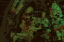
- Urban and Rural Development: Smart city management and rural development will benefit from real-time actionable information and predictive maintenance. Technologies such as photogrammetry, GIS, and drone imagery will enhance infrastructure planning and management.
- Disaster Risk Reduction: Real-time risk mapping and early warning systems for natural hazards will improve disaster preparedness and response, reducing the socio-economic impacts of disasters.
Industry Impact
- Infrastructure Optimization: Integrating Building Information Modelling (BIM) and Digital Twins for infrastructure management will lead to more efficient and effective use of resources, enhancing the quality and reliability of infrastructure projects.
- Logistics and Transportation: Enhanced route optimization and real-time tracking of transport vehicles will improve the efficiency of logistics networks, reducing costs and increasing the reliability of transportation systems.
Academic and Scientific Community Development
- Research and Development: Academia will play a crucial role in conducting research to develop innovative geospatial technologies. This will lead to advancements in the field and the generation of new knowledge, furthering academic research.
- Capacity Building: The program will train consortium members on relevant skills and technologies, enhancing the capabilities of the scientific community and ensuring a skilled workforce for future geospatial projects.
Environmental Impact
- Environmental Monitoring: The initiative will focus on monitoring air and water quality, carbon emissions, and forest-fire mapping using advanced technologies, aiding in environmental conservation and management.
- Habitat Conservation: Implementing digital twins for habitat conservation and biodiversity management will help preserve natural ecosystems and promote sustainable development.
Technological Advancements
- Geospatial Data Infrastructure: The development of Data Cubes and the use of AI and big data tools will improve the storage, retrieval, and analysis of complex earth observation data, enhancing the overall geospatial data infrastructure.
- Integration of Emerging Technologies: The program will integrate IoT, AI, and other emerging technologies with geospatial solutions, driving innovation and pushing the boundaries of what is possible with geospatial technology. Combining GNSS with IoT, AI, and big data analytics will lead to the development of advanced geospatial solutions. This integration will push the boundaries of current geospatial capabilities, driving technological innovation and efficiency.
The call for proposals by the NGP Division in Geospatial Technology and Solutions has the potential to drive significant progress across various sectors in India. By fostering economic growth, enhancing public services, driving industrial innovation, and promoting academic research, this initiative can contribute to the overall development and modernization of the country. The resulting advancements in geospatial technology will not only benefit immediate stakeholders but also have a long-term positive impact on India’s sustainable development and global competitiveness.
More details about the call (Information Brochure and format etc.) can be found on https://onlinedst.gov.in/.
The Last date for submission of online proposals is 15th July, 2024.
Source: DST