Revolutionizing Subsurface Exploration: Golden Software Unveils Latest Surfer® Mapping and 3D Visualization Package
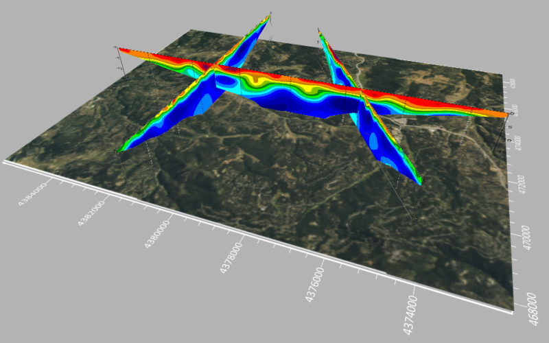
Golden Software has elevated the capabilities of its Surfer mapping and 3D visualization software, providing users with an enhanced and comprehensive view of subsurface data. The latest version of Surfer comes with expanded visualization tools, facilitating the creation of 3D grid files for the thorough examination and analysis of drillhole data.
Kari Dickenson, Surfer Product Manager, emphasized the company’s commitment to empowering users by incorporating a broader selection of options and increased flexibility into the Surfer visualization functionality. This strategic enhancement aims to enable users to maximize the potential of their 3D drillhole data, fostering a more profound understanding of the subsurface environment surrounding wells and drillholes.
Surfer boasts a user base exceeding 100,000 individuals globally, spanning diverse fields such as environmental consulting, water resources, engineering, mining, oil & gas exploration, and geospatial projects. With a remarkable track record of over 40 years, the software has been a reliable tool for users in various disciplines, swiftly transforming complex data into precise 2D and 3D visuals.
Known for its swift and powerful contouring algorithms, Surfer consistently outperforms more expensive alternatives. It facilitates the modeling of data sets, application of advanced analytics tools, and clear visual communication of results, even to non-technical stakeholders.
The latest Surfer version introduces several enhancements to enrich the user experience:
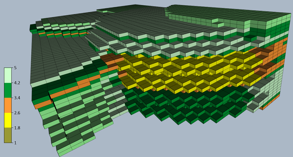
- Block Rendering: Users can now render 3D grids as a series of blocks, colorized by a selected variable. This facilitates the calculation and visualization of volumes, such as contaminants in a plume.
- Image Import: Users can directly import images of cross sections, profiles, and other features into 3D View, orienting them in any direction. This feature simplifies the creation of fence diagrams from multiple imported images or displaying raster logs alongside 3D drillholes.
- Direct Drillhole Gridding: Importing XYZC drillhole data and directly gridding it without additional steps streamlines the process, saving significant time for users.
- Assigning ‘NoData’ to 3D Grid: Users can isolate specific features in the 3D grid by assigning NoData using various methods, eliminating unwanted data outside field boundaries, well locations, or above/below specific surfaces.
As part of tradition, Golden Software has released a Beta version of Surfer concurrently with the new version, allowing users to explore new features and provide feedback during development. The Beta version introduces enhancements such as:
- Enhanced Base from Server Command: Users can connect to online servers to download XYZ Tiles for use as base maps in Surfer projects.
- Upgrades to 3D View: These include features like copying and pasting format properties, exporting 3D vector files, keyboard shortcuts for predefined 3D views, orthographic projection, orientation triad, and bounding box for improved modeling in reports and presentations.
Golden Software continues to innovate and empower users, enabling them to unlock the full potential of their subsurface data with the latest Surfer mapping and 3D visualization package. Users can explore the Beta version to experience and provide feedback on the new features in development.