
Posts From GIS Resources
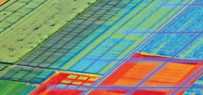
USDA Funds Bodkin Design to Develop UAV Sensor for Precision Agriculture
Bodkin Design & Engineering, LLC has been awarded a $100,000 contract from the U.S. Department of Agriculture (USDA) to develop a compact hyperspectral imager for UAV platforms. This unique camera

Iran Defines 7 Projects to Use Remote Sensing for Monitoring Agriculture
According to recent news by the Mehr news Agency, the Iranian Space Agency has defined 7 mega projects in the field remote sensing for monitoring agricultural products with high precision. Mohammad

Trimble Reports Third Quarter 2016 Results
– Third Quarter 2016 Revenue $584.1 million – GAAP Diluted Earnings Per Share $0.15; Non-GAAP Diluted Earnings Per Share $0.33 SUNNYVALE, Calif. , Nov. 1, 2016 /PRNewswire/ –Trimble (NASDAQ: TRMB)

Global Mapper LiDAR Module v18 Now Available with Full Range 3D Point Cloud Display
Blue Marble Geographics is pleased to announce the availability of an update to the Global Mapper LiDAR Module. Released in conjunction with Global Mapper version 18 the latest edition of

PrecisionHawk Brings Its Drone Data Platform to Australia
The launch of a Sydney office and partnership with agricultural powerhouse Ruralco, brings PrecisionHawk’s drone and data packages close to home for growers and businesses to get started with the

PDF3D Announces Support for macOS Sierra
Advanced 3D PDF authoring software suite supports the latest Macintosh® OS release. London, UK, October 27th, 2016 – PDF3D, from Visual Technology Services, today reaffirmed its commitment to Apple technology

IBM and Esri Team Up to Offer Cognitive Analytics and IoT in the IBM Cloud
Redlands, California—At this year’s IBM World of Watson event in Las Vegas, global smart mapping leader Esri announced that it now works with IBM users and developers to broaden the
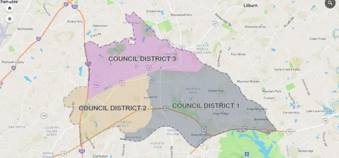
City of Tucker Launches New GIS Platform from InterDev; Debuts Web Application
Tucker, GA and Alpharetta, GA – October 25, 2016 — InterDev, an Atlanta-area provider of information technology, security and geographic information (GIS) services, today announced the City of Tucker has
PHOTOMOD Technical Seminar in Agra, India – Limited Offer
PHOTOMOD technical seminar will take place on November 16 (Wednesday). This free seminar provides a forum for professionals working in the field of photogrammetry and covers topics related to increasing

Sharjah to Conduct GIS Survey of Labour Housing Facilities
According to the recent news, the Sharjah Labour Standards Development Authority (SLSDA) is planning to adopt geographic information system (GIS) and mobile apps to survey labour accommodation in Sharjah. The Sharjah
