BAE Systems to Develop Airborne Mine-Hunting LIDAR for Manned and Unmanned Aircraft

Electro-optics engineers at BAE Systems are designing a multi-sensor suite and onboard processing to detect, identify, and pinpoint moored and drifting sea mines from manned and unmanned aircraft.
Officials of the U.S. Office of Naval Research in Washington announced an $8.9 million contract to BAE Systems Spectral Solutions LLC in Honolulu for the Passive Electro-Optics/Infrared and Light Detection and Ranging (LIDAR) Environment for In-stride Classification and Neutralization program.

Credit: Intelligent Aerospace
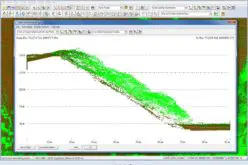
The sensor suite will consist of a visible-to-near-infrared (VNIR) multispectral imaging sensor, a broadband longwave infrared sensor (LWIR), and a 2D light detection and ranging (LIDAR) sensor, Navy researchers say.
The resulting prototype will consist of two identical pods, each housing a VNIR multispectral sensor; a broadband LWIR sensor; a 2D LIDAR sensor; a commercial off-the-shelf (COTS) laser; and control, storage, and processing electronics.
When the prototype pods are finished, BAE Systems experts will demonstrate them at a Navy test range aboard an MH-60 manned helicopter or Fire Scout unmanned helicopter that Naval Air Systems Command will provide from its headquarters at Patuxent River Naval Air Station, Md.
This contract contains options that could increase its value to $12.3 million, Navy officials say. BAE Systems will do the work in Honolulu; Hudson, N.H.; Greenlawn, N.Y.; and Manassas, Va., and should be finished by September 2017.
BAE Systems Spectral Solutions is part of the BAE Systems Electronic Systems segment based in Nashua, N.H. For more information contact BAE Systems Electronic Systems online at www.baesystems.com, or the Office of Naval Research at www.onr.navy.mil.


