Bears from Space: Scientists Try to Count Polar Bears Using Satellite Imagery
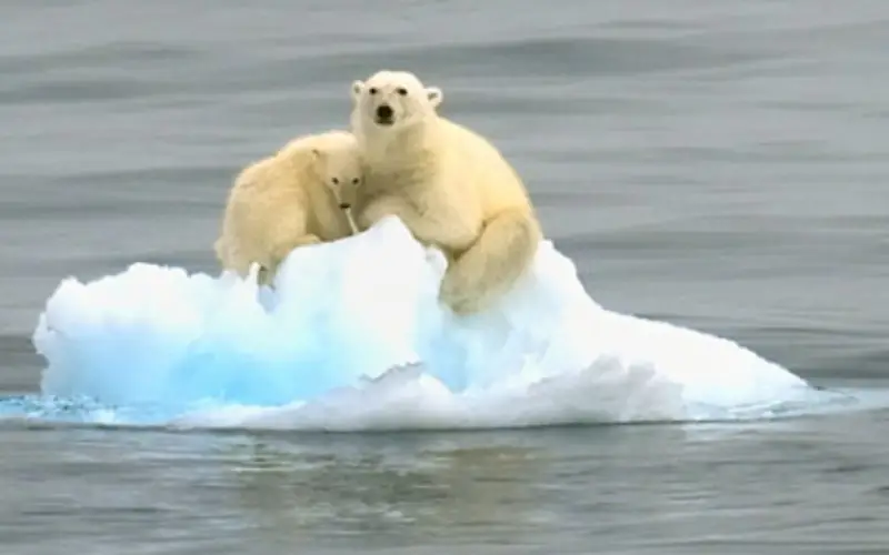
They look like tiny white specks on a mottled grey background.
They’re polar bears seen from space — using the newest tool in the kit for scientists to monitor Canada’s populations of the mighty Arctic predator.
“They really do stand out as a bright white dot against that dark grey landscape,” said Seth Stapleton, a University of Minnesota scientist pioneering the technique.
High-resolution satellite images are being increasingly used by scientists to get a look at animals living in remote, expensive-to-reach places. They’ve already been used on penguins, walruses, seals and whales.
Stapleton, who specializes in new ways to estimate bear populations, said the idea to use satellite photos came up one day while he was in the field with a colleague.
“We jokingly discussed, wouldn’t it be funny if we could do this one day with something like Google Earth,” he said.
As it happens, a researcher who has done other work with satellite imagery teaches at the same university. They got together, came up with a research plan and took it from there.
Rowley Island was selected as a site because Stapleton knew it was flat, free of snow in the summer and popular with bears. He thought bears would show up well on the uninhabited expanse of rock and gravel between Baffin Island and Melville Peninsula.
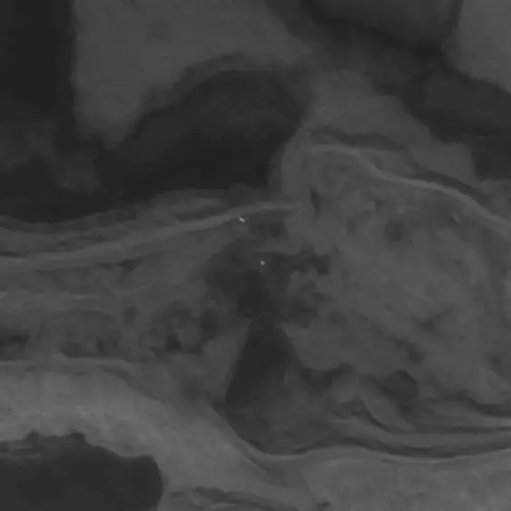
Satellite images with resolution as tight as half a metre are commercially available. Stapleton purchased two sets, one taken August 2012 and one a month later.
“It’s not rocket science,” he said.
“This is a really simple idea. All we did was compare the two images and look for the white spots that changed between image A and image B.
“If there was a white spot that was on image A that was in the right spot, the right shape, the right colouration, but was not on the second image, then that was a pretty good indication that that was a polar bear.”
The scientists later flew over the island to ensure they hadn’t been fooled by bear-like objects such as large, light-coloured rocks or chunks of ice.
Stapleton said using satellite images has a lot of advantages.
It doesn’t disturb the bears and is safer for humans. It’s cheaper and easier to set up than traditional aerial surveys, meaning scientists can check on all populations more often than the current rate of once every 15 years.
But it only works on clear days and on terrain that contrasts with the bears.
“We’re a long, long way from detecting bears on snow and ice.”
Nor is a simple count enough information to assess a bear population, said Andrew Derocher, a University of Alberta polar bear expert.
“We need much more information to make an assessment of status — body condition, movements and distribution, reproductive rates, age structure, survival rates, sea-ice conditions and harvest rates,” he said.
“Without additional context and a comprehensive monitoring plan, remote sensing of polar bears can only provide some limited insights.”
Still, Derocher agrees that satellite counts could eventually become a useful tool to track population trends.
“My guess is that our methods will ultimately be non-invasive and … remote sensing will be part of the tools.
“The imagery available from remote sensing is improving year by year. Eventually, I’m sure technology will allow us to ‘see’ every polar bear on the sea ice, monitor their kills and count their cubs.”
Stapleton is working to improve the method. His first task will be to develop computerized counting to eliminate the drudgery of manually comparing images and counting bears.
“The applications are limited right now. I do think it’s a very promising technique.”
Anyone can try it.
“We decided to poke around on Google Earth,” said Stapleton. “We’re pretty darn sure we could see polar bears.”