
Archive
Ordnance Survey Expands as a Distributor of Third-party Government Data
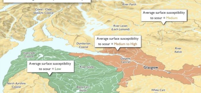
Ordnance Survey (OS), Great Britain’s leading geospatial data provider, and BGS, the UK’s leading scientific earth data provider, both Geo6 members, are driving an exciting new development. It is the

Staying Ahead: How Continuous Tech Training Fuels Innovation
Key Takeaways: Upskilling your workforce empowers them to identify areas for improvement and develop solutions, driving a culture of innovation. Strategic planning, resource allocation, and adaptable content address common hurdles

GAF AG Awarded Contract for CAP-Area Monitoring 2024 in Bavaria
As part of an ongoing process of reforms to modernise and simplify the EU’s CAP, since January 2023 the monitoring of subsidy payments has been carried out on the basis

Descartes Labs Government Accelerates Mission-Ready Solutions with EarthDaily Constellation Earth Observation Data
Descartes Labs and its subsidiary, Descartes Labs Government, has selected EarthDaily Analytics as a supplier for their Earth observation data to power their geospatial analytics and AI solutions. EarthDaily’s Constellation will unlock
Pix4D Upgrades PIX4Dcatch with Premium Augmented Reality Features for Professional Results
Pix4D, a Swiss company and leading provider of drone and terrestrial mapping and photogrammetry solutions, announces the launch of PIX4Dcatch 2.0 today. This new and improved version of Pix4D’s terrestrial
