
Archive
Russia Plans to Launch 5 Earth Observation Satellites in 2024
Roscosmos, the Russian space agency, plans to launch five Earth observation satellites in 2024. This initiative is part of a broader strategy to enhance Russia’s Earth observation capabilities. The planned
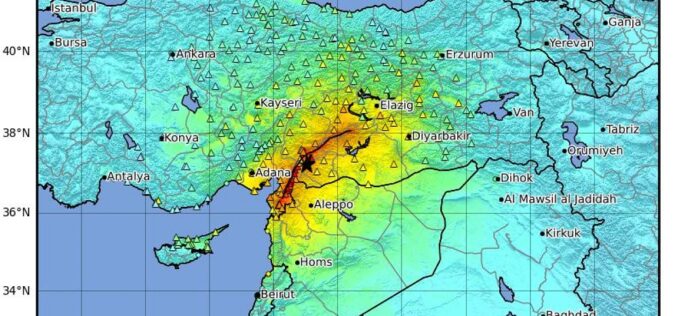
Towards Earthquake Early Warning Systems: Insights from Satellite Data on the 2023 Türkiye Earthquake
Recent studies have revealed that satellite data detected anomalies in the ionosphere up to 19 days before the devastating earthquake in Turkey on February 6, 2023, highlighting the potential for

Genesys International’s AI-Powered Navigation Map Set to Enhance Driving Efficiency
Genesys International has launched India’s first AI-powered navigation map, marking a significant advancement in driving services and transforming driving services in the country. This innovative solution, powered by advanced AI
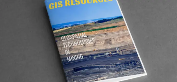
GIS Resources Magazine (Issue 2 | June 2024): Geospatial Technologies in Mining
GIS Resources is pleased to announce the publication of its 2nd edition (June 2024) of the print and digital magazine. The edition is titled “Geospatial Technologies in Mining.” Geospatial technologies are

Trimble Releases Top-Tier R980 GNSS System Delivering Greater Work Productivity for Geospatial Professionals
Trimble has introduced the Trimble R980 GNSS system, the newest addition to its Global Navigation Satellite System (GNSS) receiver portfolio. Building upon premium features available on Trimble’s latest receiver models,

MoU Signed Between Iran and Tajikistan to Promote Geomatic Sciences Research
Iran and Tajikistan have taken a significant step to enhance their cooperation in the field of geomatic sciences by signing a memorandum of understanding (MoU). The agreement, which was signed

IAI Introduces High-Tech Jam-Resistant GNSS System for Contested Airspace
In a significant advancement for aerial platform navigation, Israel Aerospace Industries (IAI) has announced the launch of its new compact, jam-resistant Global Navigation Satellite System (GNSS). This development promises enhanced

Karnataka to Implement GIS for Streamlined Construction Cess Collection
The Karnataka state government is set to implement a GIS-based construction cess collection system. It is a strategic move to enhance revenue collection and streamline administrative processes. This initiative aims

Intelpol by IGNESA Recognized for Excellence in Geospatial AI at Indian Icon Awards
IGNESA INDIA SOLUTIONS PRIVATE LIMITED, an innovative startup specializing in AI-driven geospatial solutions, has received a significant accolade at the Indian Icon Awards 2024. Their flagship product, IntelPol, was honored

Call for Proposals for Geospatial Technology and Solutions: Impact and Importance for India’s Future
The National Geospatial Programme (NGP) division, formerly NRDMS, calls for proposals in Geospatial Technology and Solutions that have the potential to impact various sectors in India significantly. The National Geospatial
