
Business
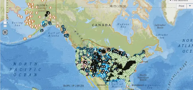
EIA’s U.S. Energy Mapping System is now Accessible on all Mobile Devices
With the 2014 hurricane season now underway, the U.S. Energy Information Administration (EIA) is making it possible for the public to track from all types of mobile devices and tablets
Top Companies Showcase Location Analytics at Esri Business Summit
The Wendy’s Company, Miele, and JLL Lead a Powerful Lineup of Businesses Maximizing ROI with the ArcGIS Mapping Platform June 12, 2014 Redlands, California—CIOs, business managers, and IT professionals from
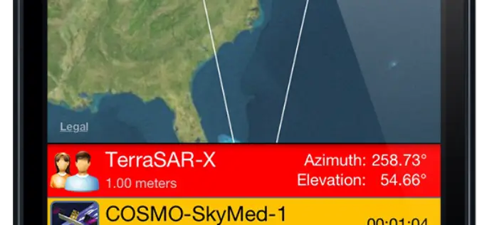
SpyMeSat Mobile App Now Offers High Resolution Satellite Imagery
Orbit Logic announced today that the iPhone version of their SpyMeSat mobile app will now offer in-app purchase of recent high resolution satellite imagery. SpyMeSat users will be able to use their
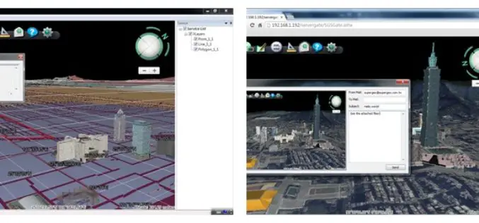
Superior 3D Map Viewing with SuperGIS 3D Earth Server Front-end Applications
To provide users a superior 3D map experience, Supergeo releases whole new front-end applications, the desktop client application, SuperGIS 3D Earth, and the browser plug-in, SuperGIS 3D Earth Plug-in, for
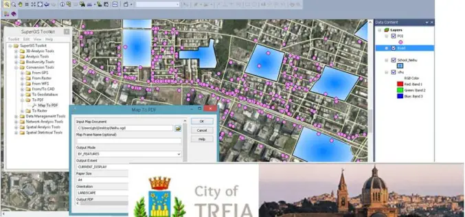
Italian Local Government Manages Urban Planning through SuperGIS Desktop
Supergeo Technologies, a leading global provider of GIS software and solutions, pleasantly announces that Urban Planning and Unique Construction Branch, Municipality of Treia, Italy selects SuperGIS Desktop to manage and
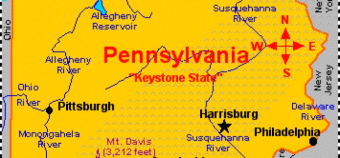
Measuring Landscape Disturbance of Gas Exploration in Nine Pennsylvania Counties
Landscape change in Pennsylvania’s Bedford, Blair, Cambria, Centre, Clearfield, Clinton, Columbia, Huntingdon, and Luzerne counties resulting from construction of well pads, new roads and pipelines for natural gas and coalbed

PR: Esri CityEngine Increases the Power of Virtual Design
Esri’s Latest 3D GIS Design Software Makes Working with Complex 3D Urban Environments Easier and Faster Redlands, California—Esri has released CityEngine 2014, the latest version of its advanced 3D GIS urban design

Discover the Northwest with Revised Montana Maps
Just in time to explore the great outdoors this summer, newly designed US Topo maps covering Montana are now available online for free download. US Topo maps now have a crisper,

SuperSurv 3.2 for iOS Supports Cloud Storage
SuperSurv 3.2 for iOS, the newest mobile GIS app released by Supergeo, enables users to import data through cloud hard drive and supports more US local coordinate systems, providing iOS

EagleView Technologies Announces Pictometry® CONNECTMobile™
(Bothell, Wash., June 3, 2014) – EagleView Technologies, Inc., a leading technology provider of aerial imagery, data analytics and GIS solutions, announces the launch of CONNECTMobile™. This latest mobile release
