
Remote Sensing
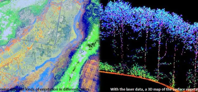
Protecting Nature Using Airborne Laser Footprint Data
In a study by Prof. Norbert Pfeifer at the Vienna University of Technology, reveals the significance of using airborne laser technology in protecting nature. The study area is ‘‘Nagyerdo˝’’ (Great
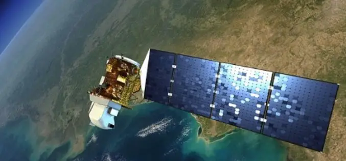
Landsat 9 to Continue Land Imaging Legacy of the U.S. Space Program
In recent news update by NASA, NASA and USGS are working together on Landsat 9, schedule to launch in 2023. NASA will build, launch, perform the initial check-out and commissioning
Over 20 Concepts For Applied Projects In “Remote Sensing Applications Competition” Launched By EIAST
The competition aims to develop mechanisms and programs that serve various governmental sectors As part of the Remote Sensing Applications Competition 2014, launched by the Emirates Institution for Advanced Science
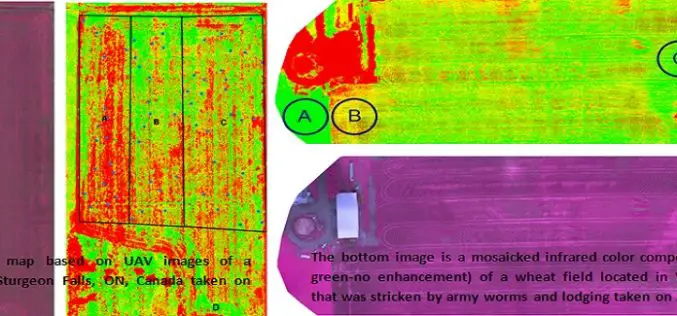
Applications of Low Altitude Remote Sensing in Agriculture
In a study by Chunhua Zhang et. al., on “Applications of Low Altitude Remote Sensing in Agriculture upon Farmers’ Requests– A Case Study in Northeastern Ontario, Canada” reveals the importance

World’s Biggest Aerial LiDAR Survey to Reveal Angkor Wat Historical Secrets
Angkor, in Cambodia’s Northern Province of Siem Reap, is one of the most important archaeological sites of Southeast Asia and listed in world heritage sites by UNESCO. Stretching over some

Tribal Ministry to Use Satellite Mapping to Develop Water Bodies
The Ministry of Tribal Affairs (MoTA) is planning to use satellite mapping to identify potential water collection spots, which could be developed for fish culture and other purposes in order
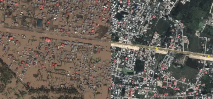
Kashmir Floods Monitored By Latest Satellite Technology
Union Minister Jitendra Singh said that Kashmir floods are being constantly monitored by latest satellite technology at the National Remote Sensing Centre. “Kashmir floods are being constantly monitored by latest
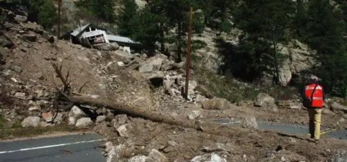
Aerial LiDAR to Study Impact of Colorado Flood on Soil Erosion
Anderson and colleagues use repeat aerial LiDAR to quantify the erosional impact of the heavy rains that inundated the Colorado Front Range in September 2013. One week of steady rain and
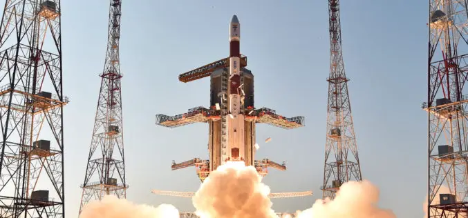
IRNSS-1D, 4th Satellite of IRNSS Constellation Launched Successfully
Today (Mar. 28, 2015) ISRO’s Polar Satellite Launch Vehicle, PSLV-C27, successfully launched IRNSS-1D from Satish Dhawan Space Centre, Sriharikota. The satellite is one among the seven of the IRNSS constellation
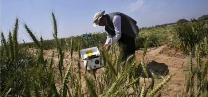
India Turns to ‘Satellite God’ for Crop Monitoring
(Reuters) – Sher Singh, a farmer from desert state of Rajasthan, prays to Varuna, the Hindu god of water, for a bountiful harvest. Now, he is also looking to the
