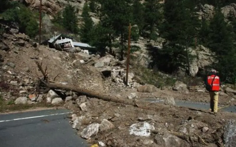
Anderson and colleagues use repeat aerial LiDAR to quantify the erosional impact of the heavy rains that inundated the Colorado Front Range in September 2013.
One week of steady rain and storm broke all rainfall records all over the state. The flood triggered more than 1,100 landslides and debris flows in a 3,430-square-kilometer.
Anderson and colleagues use before-and-after high-resolution topographic data from airborne laser mapping (LiDAR) to quantify landslide erosion.
The “before” LiDAR mapping of Boulder Creek was completed in 2010. With a few weeks of the storm, the authors repeated the aerial survey. They then subtracted the 2013 topographic data from the 2010 topographic data where the datasets overlapped—west of Boulder, Colorado—to produce a digital elevation model (DEM) of difference.
They located 120 landslides and debris flows ranging in size from 10 to 21,000 cubic meters, all on slopes greater than 20 degrees. On average, about 15 mm of lowering occurred in basins in which landslides occurred.
Other methods have shown that it takes hundreds to thousands of years to loosen this much sediment from rock. This study both highlight the importance of rare events in long-term erosion of this landscape and help to explain why modern sediment yields may greatly underestimate long-term denudation rates in such settings.
– www.phys.org