
Remote Sensing

IndiaAI and GSI Launched Hackathon on AI-Driven Mineral Targeting in India
In a pioneering effort to modernize mineral exploration, IndiaAI, an Independent Business Division under the Digital India Corporation (DIC), Ministry of Electronics & IT (MeitY), in collaboration with the Geological
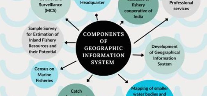
Satellite Technology in Fisheries Driving India’s Growth
India’s fisheries sector is undergoing a digital transformation, with Satellite Technology in Fisheries playing a crucial role. From real-time monitoring to resource management, these advancements are improving efficiency, ensuring sustainability,

Malaysia Satellite Program to Enhance National Space Capabilities
Malaysia is set to advance its space technology sector with the launch of the Malaysia Satellite Program in 2028. The initiative, officially known as the National Remote Sensing Satellite Development
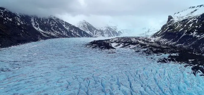
Glacier Retreat in Arunachal Pradesh Raises Water Availability Concerns
A recent study conducted by researchers from Nagaland University and Cotton University highlights a significant glacier retreat in Arunachal Pradesh. The research, spanning over three decades, indicates a worrying decline
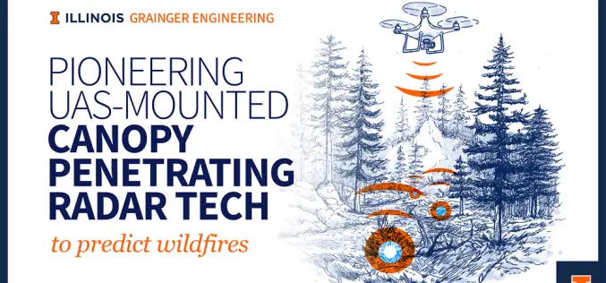
Illinois Scientists Advance Canopy-Penetrating Radar for Fire Prevention
Wildfires are unpredictable disasters that spread rapidly, leaving destruction in their path. Traditional remote sensing methods struggle to penetrate dense forest canopies, making it difficult to detect dry vegetation and
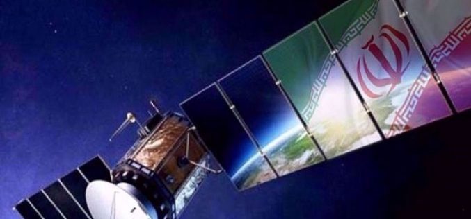
Three Advanced Iran Remote Sensing Satellites to Boost National Space Program
Iran is set to unveil three cutting-edge, indigenous satellites, significantly enhancing its capabilities in space technology. The satellites – two upgraded remote sensing satellites, Pars-1 and Pars-2, and the Navak
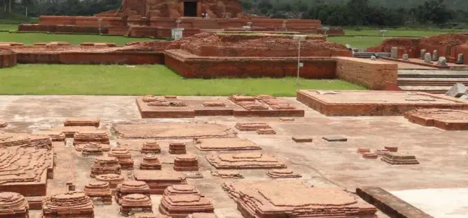
Remote Sensing Archaeology Locates Ancient Valabhi Town in Gujarat
A groundbreaking study has utilized remote sensing archaeology to uncover the location of the ancient town of Valabhi in Gujarat, India. Valabhi, once the thriving administrative capital of the Maitraka

USGS Unveils First Map of Geologic Hydrogen in the U.S.
The U.S. Geological Survey (USGS) has released a groundbreaking map highlighting potential regions for Geologic Hydrogen in the contiguous United States. This innovative tool represents a significant step forward in

PRSC-EO1: Pakistan’s First Indigenous Electro-Optical Satellite Launched
Pakistan has achieved a significant milestone with the successful launch of its first indigenous Electro-Optical satellite, PRSC-EO1. The satellite was launched on January 17, 2025, from China’s Jiuquan Satellite Launch

Laos Embraces Satellite Technology for Carbon Credit Feasibility
Laos is taking significant steps towards sustainable development by leveraging satellite remote sensing to evaluate carbon stocks across nine forest areas, covering 170,556 hectares. This initiative, led by the Ministry
