The U.S. Geological Survey (USGS) has released a groundbreaking map highlighting potential regions for Geologic Hydrogen in the contiguous United States. This innovative tool represents a significant step forward in identifying clean energy sources and advancing the nation’s sustainability goals.
What is Geologic Hydrogen?
Geologic Hydrogen, also referred to as “white” or “gold” hydrogen, is naturally produced through processes such as water-rock reactions and radiolysis—the splitting of water molecules by radiation. Unlike industrial hydrogen production methods, geologic hydrogen is a naturally occurring, potentially carbon-neutral energy source. This makes it an attractive option for low-carbon energy systems.
Also Read – USGS Advances Colorado Geological Mapping with Low-Flying Helicopters
Key Regions Identified for Geologic Hydrogen
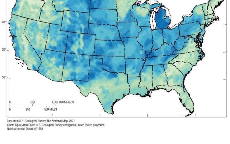
The USGS map pinpoints several promising regions for geologic hydrogen accumulation. These include:
- The mid-continent area (Kansas, Iowa, Minnesota, and Michigan)
- The Four Corners states (Arizona, Colorado, New Mexico, and Utah)
- The California coastline
- The Eastern seaboard
Each area shows potential based on favorable geological conditions, including the presence of hydrogen sources, reservoir rocks, and effective seals to trap the gas.
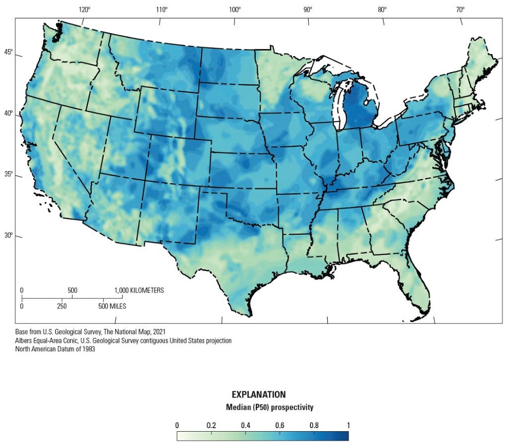
Sources Map created by USGS.
Why is This Map Important?
The Geologic Hydrogen Prospectivity Map is a vital resource for energy exploration. By integrating multiple datasets, the USGS has created a tool that can guide policymakers, researchers, and industry stakeholders toward areas worth investigating further.
This is especially significant given the global push to reduce greenhouse gas emissions. Hydrogen could play a pivotal role in diversifying energy portfolios and enhancing energy security while supporting environmental sustainability.
A Step Toward Clean Energy
This map is more than just a scientific achievement—it is a call to action for further exploration and research. Understanding where geologic hydrogen is most likely to accumulate can help unlock its potential as a viable energy resource.
As the world transitions to low-carbon energy systems, this could become a cornerstone of clean and sustainable energy production.
In conclusion, the USGS’s first-ever map paves the way for new advancements in energy research. By identifying promising regions, it provides a roadmap for future exploration and a step toward achieving energy security and sustainability.