
Remote Sensing

Uzma Berhad Launches Malaysia’s First High-Resolution Earth Observation Satellite – UZMA SAT-1
Uzma Berhad, a prominent Malaysian oil and gas services provider, has successfully ventured into space technology with the launch of its first Earth observation satellite, UZMA SAT-1. This milestone was

UNL and USDA Collaborate on a Web-Based Soil Sampling Tool
A collaborative effort between the University of Nebraska–Lincoln (UNL) and the U.S. Department of Agriculture (USDA) has led to the development of the Soil Sample Planning Organizer Tool (SSPOT), a

Hyperspectral Plastic Detection for Riverine Cleanup
Plastic pollution in rivers is a growing environmental challenge. With millions of tons of plastic waste flowing into oceans annually, the need for effective monitoring and cleanup has never been
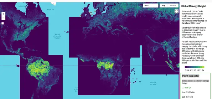
AI-Powered Tree Canopy Map by Meta and WRI
Meta, in collaboration with the World Resources Institute (WRI), has launched an advanced AI-powered Tree Canopy Map that provides unparalleled accuracy and detail in monitoring forests worldwide. By analyzing trillions
YES-TECH Revolutionizes Pradhan Mantri Fasal Bima Yojana Implementation
The Pradhan Mantri Fasal Bima Yojana (PMFBY) has entered a new phase, integrating advanced technologies such as satellite imagery, drones, unmanned aerial vehicles (UAVs), and remote sensing for enhanced accuracy
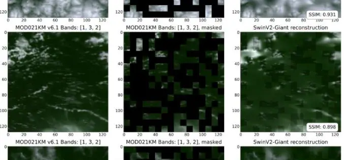
NASA’s SatVision TOA Revolutionizes Cloud and Aerosol Modeling
NASA’s Goddard Space Flight Center (GSFC) continues to push the boundaries of Earth observation science with the release of the SatVision Top-of-Atmosphere (TOA) Foundation Model. Developed by the GSFC Data
Karnataka Adopts Satellite Forest Monitoring To Tackle Encroachments
In a groundbreaking move, Karnataka has introduced satellite surveillance to combat illegal forest encroachments, aiming to safeguard its green cover and ecological balance. This innovative system, known as the Forest
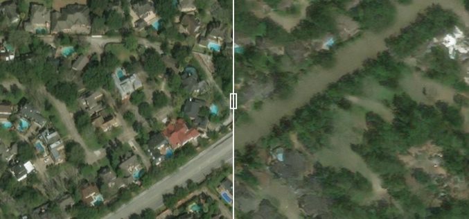
Predicting Flood Impacts with Generative AI and Physics-Based Models
Understanding the potential effects of hurricanes before they strike is crucial for helping residents prepare and take necessary actions, such as evacuation. Researchers at MIT have developed an innovative approach

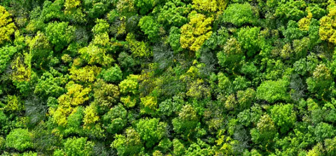
How Forest Mapping in Japan Enhances Carbon Sequestration
Accurate forest information is crucial for effective climate change strategies. Forests, covering about a third of the Earth’s land area, play a pivotal role in carbon sequestration—absorbing carbon dioxide from
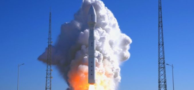
Oman First Satellite Launch: A Major Leap in Space Technology
Oman has achieved a significant milestone in space technology with the Oman First Satellite Launch (on November 11 2024) of its pioneering satellite, “OL-1.” The launch, represented by Oman Lens
