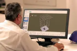
For almost four decades, the TerrSet/IDRISI geospatial software from Clark Labs has played a key role in environmental monitoring, enabling researchers to analyze climate change effects and predict future land cover changes.
As of December 2, the software will become freely accessible under the name liberaGIS, thanks to a new initiative from the Clark Center for Geospatial Analytics (Clark CGA).
This shift comes following the merger of Clark Labs with Clark CGA, which has enabled broader access to TerrSet/IDRISI. Ron Eastman, a professor emeritus and former director of Clark Labs, now serves as a senior researcher at the new center. He explained that the decision to offer an open-access version of the software stems from the desire to expand its use globally.
Also Read – Free and Open Source SAR Image Processing Software
TerrSet/IDRISI was initially released in 1987, and since then, more than 100,000 users in nearly every country have utilized the software. Researchers and educators at Clark University have integrated the system into their work, particularly for Geographic Information Science (GIS) instruction and research.
The latest release, liberaGIS, introduces several key upgrades. Among them is the enhanced Land Change Modeler, which supports REDD (Reducing Emissions from Deforestation and Forest Degradation) frameworks to help governments manage forests and address climate change impacts. Another major addition is a tool within the Earth Trends Modeler that allows for the analysis of climate teleconnections, identifying long-term climate patterns like El Niño and La Niña.
Additionally, liberaGIS offers a new suite of raster editing tools. This feature is especially valuable for satellite imagery, enabling more efficient editing, drawing from Clark Labs’ decade of experience mapping shrimp aquaculture’s effects on tropical mangroves.
To streamline the software, several outdated components will be removed, including tools from the National Center for Atmospheric Research and the U.N.’s ECOCROP database. These removals reflect the software’s evolution, with newer tools taking their place.
In preparation for the open-access release, TerrSet licenses will be offered at steep discounts. Starting August 28, licenses will be 25% off, with further reductions of 50% and 75% planned for October and November.
The launch of liberaGIS marks a new chapter for TerrSet/IDRISI, making powerful geospatial analytics accessible to users worldwide.
Source: Clark Center for Geospatial Analytics