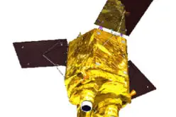
Synthetic aperture radar (SAR) is a type of radar that uses the motion of the sensor platform to create a synthetic long-baseline antenna array. This process allows for high-resolution imaging even when the target is located far from the radar system. Sensor data acquisition and processing are essential in many civil and defense applications such as object detection, recognition, and tracking.
With the increased availability of low-cost and open-source satellite data, the need for software to process and analyze those data has followed. The growing availability of SAR data has led to a corresponding need for software that can process and analyze these data sets. In response, a number of free/open source software packages have been developed to fill that need. This blog post will introduce the best free/open source SAR Image Processing Software packages and provide a brief overview of their features.
What
is Open Source Software?
Open-source software is software for which the original source code is made freely available and may be redistributed and modified. The term open-source software is often used to describe software that is licensed under the GNU General Public License (GPL), a copyleft license. Free and Open Source Software (FOSS) provides an appealing solution to this need, as it allows users access to the source code and promotes collaboration.
The availability of free and open-source software has led to the development of a number of SAR image processing software packages. This section provides a brief description of some of these software packages.
What is SAR image processing?
SAR image processing is the process of extracting information from synthetic aperture radar (SAR) images. The term “synthetic aperture” means that the radar signal is synthesized from multiple observations of the target, as opposed to a single observation with a moving antenna. This greatly increases the resolution of the image.
In other words, SAR is a type of radar that uses a moving antenna to create a synthetic aperture, allowing it to produce high-resolution images even though the aircraft or satellite may be moving at high speeds.
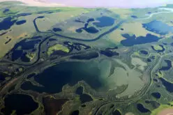
SAR systems produce images by transmitting microwave energy toward the Earth’s surface and recording the reflections. The reflections are used to generate an image of the terrain.
SAR image processing is the process of extracting useful information from synthetic aperture radar (SAR) images. SAR images are composed of a large number of individual radar pulses. By exploiting the Doppler effect, SAR systems are able to produce images of targets even through adverse weather conditions. SAR image processing is used to extract features from SAR images, including position, shape, and size.
Also, read – Solar Induced Chlorophyll Fluorescence – A Better Predictor of Crop Stress through Satellite Remote Sensing
There are numbers of commercial and open source SAR image processing software packages are available in today’s world. Some of the commercial SAR image processing software are “ERDAS IMAGINE” and “ENVI”.
A few popular free/open source SAR image processing software package is “SARscape”.” SARscape was specifically designed for the analysis of Synthetic Aperture Radar (SAR) images. It can be used to extract feature information from SAR images, and to create 3D images from 2D data.
There are a few different open source SAR image processing software programs that allow for the manipulation and analysis of SAR images. One of the most popular is called the “Sentinel-1 Toolbox (S1TBX).” Sentinel-1 Toolbox (S1TBX) is a collection of processing tools, data product readers and writers, and a display and analysis application designed to support the large archive of data from ESA SAR missions such as Sentinel-1, ERS-1 & 2, and ENVISAT, as well as third-party SAR data from ALOS PALSAR, TerraSAR-X, COSMO-SkyMed, and RADARSAT-2. It can be used to extract feature information from SAR images, and to create 3D images from 2D data.
List of Open Source SAR Image Processing Software
There are a number of open-source software programs that allow you to process SAR images.
Following is the list of the 13 most popular Open Source SAR Image/Data Processing Software:
1. Doris InSAR Processor: The Delft Institute of Earth Observation and Space Systems of Delft University of Technology has developed an Interferometric Synthetic Aperture Radar (InSAR) processor named Doris (Delft object-oriented radar interferometric software). The Doris software can be downloaded free from this site for non-commercial applications (conditions). Interferometric products and end products such as Digital Elevation Models and displacement maps can be generated with this software from Single Look Complex data. Data from the satellites ERS, ENVISAT (first ENVISAT interferogram, 54kB, DEM, 107kB, and perspective view, 177kB), JERS (first JERS interferogram), and RADARSAT (first RADARSAT interferogram) can be processed with the Doris software.
2. GMTSAR: GMTSAR is an open-source (GNU General Public License) InSAR processing system designed for users familiar with Generic Mapping Tools (GMT). The code is written in C and will compile on any computer where GMT and NETCDF are installed. The system has three main components: (i) a preprocessor for each satellite data type (ERS-1/2, Envisat, ALOS-1, TerraSAR-X, COSMOS-SkyMed, Radarsat-2, Sentinel-1A/B, and ALOS-2) to convert the native format and orbital information into a generic format; (ii) an InSAR processor to focus and align stacks of images, map topography into phase, and form the complex interferogram; (iii) a postprocessor, mostly based on GMT, to filter the interferogram and construct interferometric products of phase, coherence, phase gradient, and line-of sight displacement in both radar and geographic coordinates.
3. ISCE: ISCE is a framework designed for the purpose of processing Interferometric Synthetic Aperture Radar (InSAR) data. Its initial development was funded by NASA’s Earth Science Technology Office (ESTO) under the Advanced Information Systems Technology (AIST) 2008 and is currently being funded under the NASA-ISRO SAR (NISAR) project. The advantages of ISCE include (i) its easy-to-access, free-of-charge, and public domain nature; and (ii) the fact that NISAR is an expandable platform supporting many SAR sensors including the upcoming NASA L-band SAR mission NISAR.
Also, read – NISAR – NASA-ISRO Synthetic Aperture Radar Mission
4. Map Ready: The Alaska Satellite Facility distributes Map Ready. It is free, but not open, and may be restricted if you live in a country with a poor relationship with the United States. Users can utilize the MapReady Remote Sensing Tool Kit to process SAR data from a range of missions, including datasets from ASF and other suppliers, as well as some optical data. MapReady is especially handy for working with CEOS-formatted SAR datasets. Please keep in mind that MapReady is not suitable for processing Sentinel-1 products. MapReady’s platform is limited to earlier missions in ASF’s portfolio, notably ALOS Palsar. To process Sentinel-1 data, use the Sentinel-1 Toolbox included with the Sentinel Application Platform (SNAP).
5. Next ESA SAR Toolbox (NEST): The Next ESA SAR Toolbox (NEST) is an easy-to-use open source toolbox for reading, post-processing, analyzing, and visualizing massive archives of data (from Level 1) from ESA SAR missions such as ERS-1 and 2, ENVISAT, and Sentinel-1. NEST also handles products from third-party missions like as JERS-1, ALOS PALSAR, TerraSAR-X, Radarsat-2, and Cosmo-Skymed.
Also, read – Benefits and Potential of RADAR Satellites: TerraSAR-X and TanDEM-X
6. OSARIS: OSARIS stands for Open Source SAR Investigation System is a framework facilitating interferometric processing of large stacks of Sentinel-1 (S1) Synthetic Aperture Radar (SAR) in parallelized HPC environments. Basing on BASH scripts, GMTSAR and SLURM, it is highly flexible and scales to extremely high performance on large clusters.
7. PolSARPro: PolSARPro is a free suite provided by the European Space Agency. Polarimetric processing tools for Dual and Quad-pol SAR data are included in the package. PolSARPro is The tool for processing polarimetric SAR data. It is quite straightforward to use, and there is plenty of help available (including background material on SAR polarimetry). PolSARPro does not provide terrain correction, but it does have a connection to ASF’s Map Ready, so if you have that application, you can effortlessly correct your PolSARPro products in Map Ready.
8. Radar Tools (RAT): RAT (Radar Tools) is a modest set of tools for sophisticated image processing of SAR remote sensing data that began as a student project and is now being developed at the Technical University of Berlin’s Department of Computer Vision and Remote Sensing. It’s written in IDL (Interactive Data Language) and has a graphical user interface made up of IDL widgets. Speckle filters, polarimetric basis transforms and decompositions, as well as several interferometric routines like coherence computation and interferogram filtering, are examples of current features. RAT runs on a variety of operating systems and is freely available.
9. ROI_PAC: ROI_PAC (Repeat Orbit Interferometry PACkage) is a powerful open source software package for processing diverse satellite interferometric synthetic aperture radar (InSAR) data, and has been used in numerous geophysical applications. It was developed and is maintained by a team at Caltech/JPL.
10. SARbian: SARbian has been developed by the SAR-EDU Remote Sensing Education Initiative team at the Friedrich-Schiller University Jena and from the EO College online platform. The free software suite is a Linux live system based on Debian and includes free and open Synthetic Aperture Radar (SAR) processing software. It is a new plug’n play operating system that bundles freely available Synthetic Aperture Radar (SAR) processing software for easy installation to help users start processing data. The operating system is available as a .iso file and virtual machine (.OVA). In addition, experienced Linux users can build their own SARbian .iso file by adapting the build scripts. In order for the software to run in a stable way, a system with 8GB RAM and a quad-core processor is recommended.
11. Sentinel-1 Toolbox: The Sentinel-1 Toolbox (S1TBX) consists of a collection of processing tools, data product readers and writers, and a display and analysis application to support the large archive of data from ESA SAR missions including Sentinel-1, ERS-1 & 2, and ENVISAT, as well as third party SAR data from ALOS PALSAR, TerraSAR-X, COSMO-SkyMed, and RADARSAT-2. The Toolbox includes tools for calibration, speckle filtering, coregistration, orthorectification, mosaicking, data conversion, polarimetry, and interferometry. The Sentinel-1 Toolbox is being developed for ESA by Array in partnership with DLR, Brockmann Consult, and OceanDataLab.
12. Sentinel-1 RTC Stack Processor: The radiometric terrain correction (RTC) stacking tool facilitates time-series analysis of such phenomena as flooding events, deforestation, or glacier retreat. This tool creates a stack from a set of Sentinel-1 RTC products produced on the ASF HyP3 system. It also works for a co-registered set of PALSAR RTC products. In fact, the tool can accept any UTM projected co-registered set of images. The stack tool allows the user to perform sub-setting, resampling, grouping, filtering and culling on the stack. The final products are a stack of processed GeoTIFF and an animated GIF of the stack.
13. StaMPS: StaMPS (Stanford Method for Persistent Scatterers) is a software package that implements an InSAR persistent scatterer (PS) method developed to work even in terrains devoid of man-made structures and/or undergoing non-steady deformation. This processing service is the StaMPS Permanent Scatterer (PS).
Conclusion
The above-listed free/open-source SAR image processing software is the best in the world of open source for SAR image processing. Individual favorite software could vary from person to person. Maybe an individual software may not be enough to qualify all the SAR image processing requirements. However, a combination of 2 or more open-source SAR image processing software packages (such as RAT, PolSARPro, and Map Ready) can offer almost everything required to process, analyze and visualize SAR images.
Let us know which is your favorite open source software and why in the comment section.